
Territory Planning is a feature of Salesforce designed to help you build optimal territories for your sales reps. But what does that mean, exactly?
Planning is all part of effective territory management. During this stage, you work on aligning each region with geographic, account, and sales data to ensure the best coverage for priority customers and high-value areas.
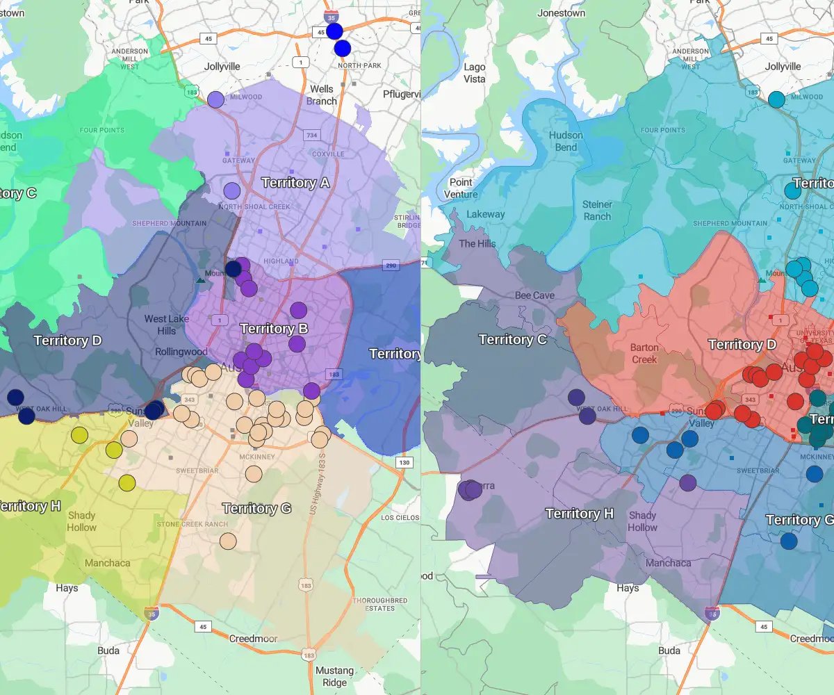
Balancing these territories allows you to distribute opportunities for your sales reps equitably. And, as plans change, optimization enables you to swiftly pivot as needed to stay agile. Planning out each territory map can help your organization boost sales team efficiency and productivity while maximizing revenue potential.
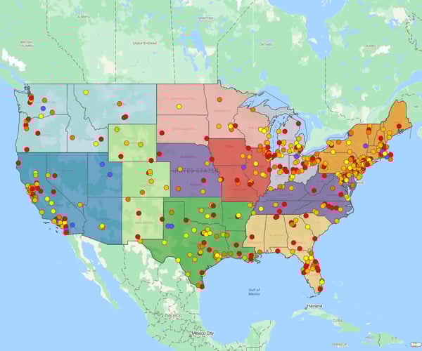
Salesforce territory planning begins with your data: customer accounts, leads, sales performance metrics, and geographic information. The system allows you to group accounts into territories based on logical criteria, such as ZIP codes, sales potential, or customer type.
Once territories are defined, Salesforce allow you to visualize them and assign them to the appropriate reps. You can test different alignments, simulate outcomes, and push the final design directly to your Salesforce CRM. This ensures your entire team is aligned and working with the latest version of the territory plan.
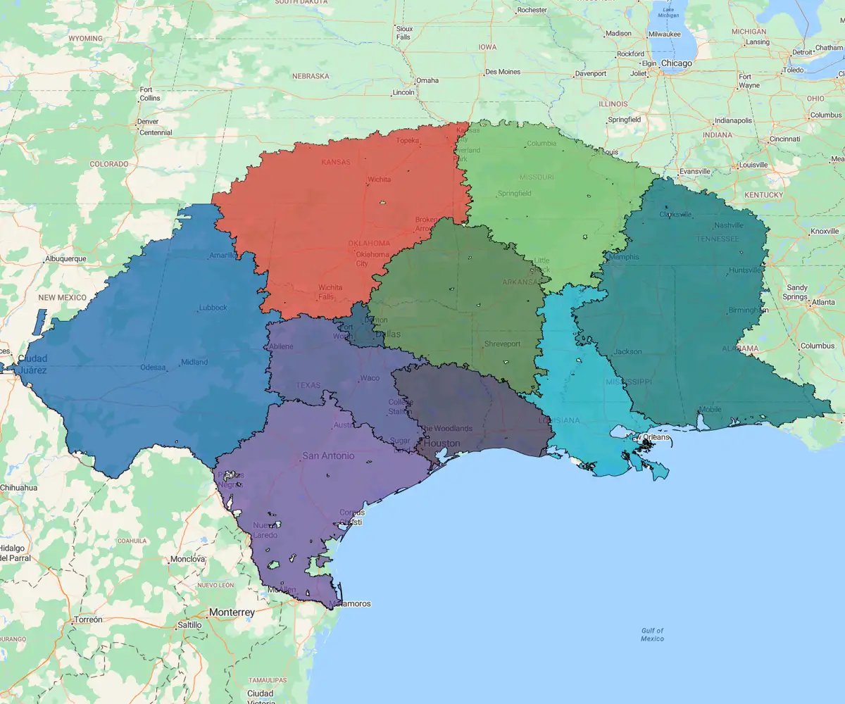
Using a solution like mapping software for Salesforce extends this functionality by allowing for greater visualization, territory optimization, and scenario modeling, all in a user-friendly interface.
Salesforce can simplify territory management, but the platform has some limitations. Before you make a decision on your sales territory mapping software, it's important to consider some of the common challenges organizations face while using Salesforce Maps:
- It cannot track deals, restricting visibility into the sales process within territories
- The focus on existing customer data makes it difficult to uncover new prospects and opportunities
- Set up, configuration, and customization can be incredibly tedious and time-consuming
- A steep learning curve and unintuitive software interface mean that it takes a while to use efficiently
- Salesforce Maps is often more expensive than alternatives that do just as much, if not more
Today's reps, sales managers, and ops teams work in a highly competitive environment. Sure, Salesforce Maps beats the traditional territory mapping process, but how does it stand up to modern solutions?
The challenges above outline some primary reasons organizations use alternative territory planning software. In addition to these concerns, many companies are apprehensive about using Salesforce Maps because of the strict licensing requirements or the inability to use non-Salesforce data in their analyses.
Moreover, its customer support representatives aren't experts in the software, as they weren't the ones who built it.
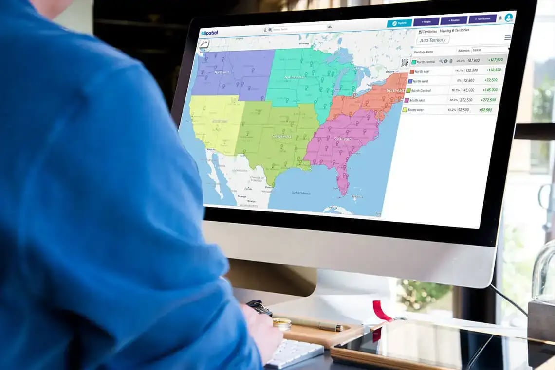
For these reasons, many companies use an integrated sales territory planning solution, like eSpatial. It offers the ability to automate maps with eSpatial, saving time and improving accuracy across large, evolving territories.
When you pair eSpatial with Salesforce territory planning, you're not just improving maps, you're upgrading your entire go-to-market strategy. The integration supports smarter territory design, efficient routing, and real-time performance analysis.
Here's what you can expect from a seamless integration:
1. Make Data-driven Territory Plans and Maps
By combining data from both existing customers and the wider target market, you can create vibrant territory maps that deliver real insights. For instance, eSpatial can help sales managers identify coverage gaps and underperforming regions. Once you see there's a problem, it's easy to dig into the data to find the root cause and implement a solution.
2. Improve Sales Performance Across the Board
Territory alignment and balance are essential to ensure complete coverage and equal workloads. By tracking leads and forecasting opportunities, you can create proactive territory plans that boost sales potential. By balancing your territories, sales reps can devote more time to giving leads and customers the attention they need.
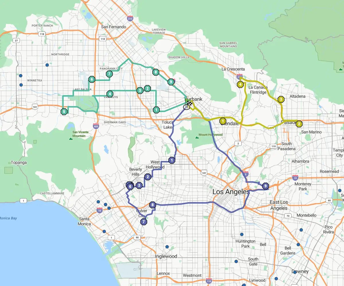
3. Minimize Travel Time and Expenses
Too often, sales reps are sent out on inefficient routes that waste time and money on essentials like fuel, maintenance, and repair. eSpatial accounts for these factors, helping you create manageable territories and your reps close more deals. Additionally, eSpatial only generates the most efficient routes for your reps to cut down on costs and save more time for selling.
4. Drive Greater, More Sustainable Revenue Growth
As market demands shift, competition increases, and other external factors influence your opportunity distribution, you'll need a way to make quick adjustments. With territory planning software, you can uncover struggling areas that need additional support. The centralized view and location intelligence also help you discover emerging trends and dig deeper into your data to spot new opportunities to grow your customer base and revenue.