When you sign up for a paid eSpatial account, you get a mapping tool that lets you easily overlay your own data onto a number of pre-made boundary and demographic datasets. These are presented in map form and you can access them via the datastore in your eSpatial account (Add Data > Add From Library). There are over 100 third party datasets for you to choose from.
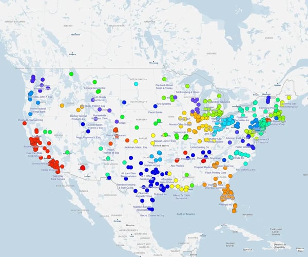
Realize the full potential of your data by juxtaposing it with ours at county, state or world-wide level. Preview all our datasets below.
Important note: If you can't find the data that you are looking for, contact us and we will see if we can source it for you. We're always looking to expand and enhance our dataset library.
Boundary
- US State Boundaries
- US State Contiguous Boundaries
- US Combined Statistical Area Boundaries (CSA’s)
- US Metropolitan/Micropolitan Area Boundaries (MSA’s)
- US Congressional Districts (111th)
- US States and Canadian Provinces
- US Counties and Canadian Census Divisions
Demographic
- State Population Report
- County Population Report
- CSA Population Report
- MSA Population Report
- State Age/Sex Report
- County Age/Sex Report
- Metropolitan/Micropolitan Areas (MSA) Age/Sex Report
- Combined Statistical Areas (CSA) Age/Sex Report
Income
- State Income Report
- County Income Report
- MSA Income Report
- CSA Income Report
Race
- State Race Report
- County Race Report
- MSA Race Report
- CSA Race Report
Education
- State Education Report
- County Education Report
- MSA Education Report
- CSA Education Report
Rent / Mortgage
- State Rent/Mortgage Report
- County Rent/Mortgage Report
- MSA Rent/Mortgage Report
- CSA Rent/Mortgage Report
Housing
- State Housing Report
- County Housing Report
- MSA Housing Report
- CSA Housing Report
Boundary
- Canadian Boundary Provinces and Territories
- Canadian Census Division
- Canadian census metropolitan/agglomeration areas
- Canadian Federal Electoral Districts
- Canadian Forward Sortation Areas
- US Counties and Canadian Census Divisions
Demographic Datasets
- Demographic/Population Canadian Census Division
- Canadian census metropolitan /agglomeration areas
- Canadian Age/Sex Census Division
- Household Type Canadian Census Division
- Language Canadian Census Division
- Canadian Age/ Sex census metropolitan/agglomeration areas
- Canadian language census metropolitan /agglomeration areas
Boundary Datasets
- English Government Office Boundaries
- UK Postcode Areas
- UK Postcode Districts
- English Postcode Sectors
Demographics Datasets
- Government Office Region Demographics Report
- County and Unitary Authority Demographics Report
- Local Authority Demographics Report
- Ward Demographics Report
- Population per Scottish Councils
Economic Activity
- Government office region Economic Activity Report
- County and Unitary Authority Economic Activity
- Local Authority Economic Activity Report
- Ward Economic Activity Report
Education Datasets
- Government Office Region Education Report
- County and Unitary Authority Education Report
- Local Authority Education Report
- Ward Education Report
Tenure Datasets
- Government Office Region Tenure Report
- County and Unitary Authority Tenure Report
- Local Authority Tenure Report
- Ward Tenure Report
Datasets Available
- Irish Provinces Map
- Irish Counties Map
- Irish Provinces Education Report
- Irish Counties Education Report
- Irish Provinces Housing Report
- Irish Counties Housing Report
- Irish Provinces Population Report
- Irish Counties Population Report
- Irish Provinces Age/Sex Report
- Irish Counties Age/Sex Report
Datasets Available
- Belgium 4 digit Postcodes
- Czech Republic Districts
- Danish Municipalities
- Finland Postcodes
- French Department Boundaries (2 Digit Postcodes)
- German 2 Digit Postcodes (2019)
- German 5 digit Postcodes
- Netherlands 2 digit postcodes
- Netherlands Postcodes (4 Digit Boundaries)
- Slovakia Districts
- Spanish Provinces (2 Digit Postcodes)
- Swedish Counties
- Swedish Municipalities
- Switzerland 4 digits postcodes
- Swiss Districts 2022
Boundary Datasets
- Australian State Boundaries
- Australian State Electoral Divisions
- Australian Postal Areas
- Australian Local Government Areas
- Demographic State Electoral Divisions
Demographic Datasets
- Australian Age/Sex Local Government Areas
- Australian Age/Sex State Electorial Divisions
- Demographic State Electoral Divisions
- Income State Electoral Divisions
- Income Local Government Areas
- Occupation State Electoral Divisions
- Occupation Local Government Areas
- Education State Electoral Divisions
- Education Local Government Area
- Tenure State Electoral Divisions
- Tenure Local Government Area
Datasets Available
- Argentina Provinces
- Brazil States and Federal Districts
- Chile Regions
- Colombia Departments
- Peru Regions
Datasets Available
- World Country Boundaries Map