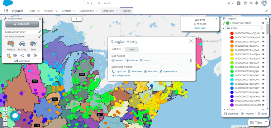
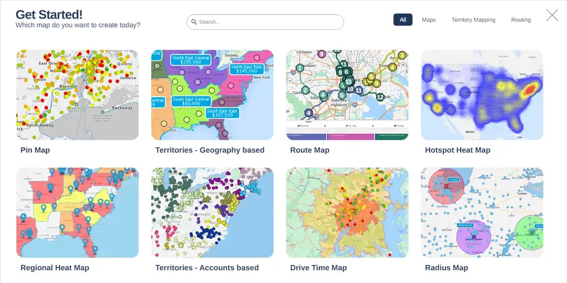
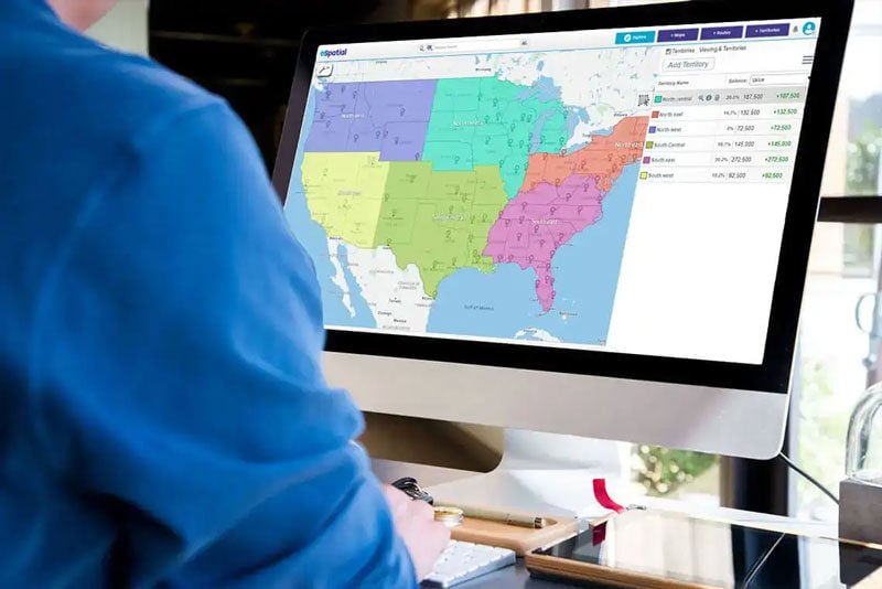
Hi Liam, welcome back we have a new member of the team joining us this time around, hi Orsi. Hi everyone. Hi Ronan. Good to see you, glad you joined us and I think we have a short enough session today. Liam you and I were chatting about, well, it was specifically about a couple of customers of ours and we were thinking about this idea of real estate which is a big part, you know we've got quite a few customers in the real estate space who actually use eSpatial as part of their sales process and so I thought what, you know, we thought it might be a good idea to just show people a couple of ideas in terms of how you can actually use the map to basically sell, included in your sales process, and so I'm going to kind of hand it over to you Liam and maybe we can talk about, I suppose the obvious advantage of maps over other communication sets, pieces, or media.Yeah, absolutely, yeah more than happy to to run through that, yeah I can share my screen and, yeah, what we've seen over the last, I suppose, number of years from the customers that we've worked with in the real estate spaces that they're seeing the power of mapping and they're adding a mapping software to their arsenal to help sell their properties so let me give you a scenario that we hear all the time is that let's say I'm a real estate agent I'm in my office and I'm on a Zoom call with a potential buyer, the potential buyer is interested in, let's say, this area, this suburb North of Indianapolis and we can then zoom in and filter down to maybe showcase the 3 properties in question. You can, the real estate agent or myself can then click on each property get all the information relevant to each property but one of the things that is big for this area could be new families are coming to this region and they want to see what schools are close by so you can then easily toggle in a layer of school locations, so you can see all the schools that are close by, quite easily we can we can see them we can take it one step further and we can maybe just if you wanted to see what type of schools if they're elementary or high schools, middle schools and what are close by. These are just simple layers you can add in and we can also see what recreational facilities are close by, so you can see that there is 5 parks within walking distance of these 3 properties can I... Liam sorry, can I just ask you where that school information, just a matter of interest, where did you get that in order to be able to layer it?Yeah, so some of our customers would actually source it themselves or what they could use is our business search. So in our in the top of our screen here, in our address search bar we have a business search that will return back 20 results at a time so for looking for, like the next example, which we'll run through which is hospitals. We can then see what medical facilities or hospitals are close by to,to your search area so we can clearly see here I'm the agent here and we can see, yep,there are 3 hospitals in close proximity to these property locations or this neighborhood.So these are the, I suppose, the power of mapping that real estate agents are finding is thatthey're not just showing a spreadsheet or a list of what's close by, they can show thator communicate that through the power of a map and it's the type of information that ismuch easier to understand and from just looking at a database or just looking at a spreadsheetor a list of what's close by. Yeah and so let me ask you question then so because you'vepictured a nice scenario, maybe I'm on a Zoom call but how do I share this information maybe with apotential buyer? So let's say I'm on Zoom today and I'm having that conversation I'm showingthem a live map but now I want to arrange a call and I want to visit them tomorrow maybe to showthem these properties but send them this info in advance. Yeah, so if you wanted to share thisinformation after or in advance, there's a number of ways that you can share out the mapsso you can export the maps through a PDF or a readymade PowerPoint booklet which I thinkwould be, which we are finding, that our real estate customers are using a lot. Or you'd alsobe able to print out a map, or you can share a interactive public map link, so you can sharethat in an email to the potential buyer and thenhe or she will be able to zoom in, zoom out,access all the different layers on the map after or prior to any meeting that you have with them.Oh so, sorry Liam, so just... I'm a bit slow as you know,so really what you're saying is you can send mea link that will bring up a live map of what I'm now looking at and then I can go in and basicallyplay around with it and get the information that you just shared with me live, yeah? Absolutely, yep!Okay, no, that's... Is it the read only option isn't it? Yeah, that's correct Orsi, so yeah the enduser looking at the map, they won't be able to make any changes or export or anything, so yeah it'sjust more of an interactive view, as you said, a read only view, correct. Great, great andI'm assuming Liam, at the very start, you mentioned that you had filtered so you could have all ofyour properties but what you did is you filtered which we can you know we could show people again,you basically filter down to those, oh I see, okay. Yeah so you're going to do this live for me cool. Yeah so I'm just looking at, let's say, the properties within this neighborhood butmaybe they want to expand out to search, maybe, to different areas, maybe they want to lookat apartments as well as condos or any type of property type so you'd be able to colorcode and filter based off any of the information you have in your, I suppose, property dataset likesquare footage, property type, number of bedrooms/bathrooms,all that good stuff so you can profile and target...Sorry Liam, so those purple dots could potentially be,represent, 4 bedroom apartments or 4bedroom properties in blue, so you can color code and categorize your properties the way youlike I guess? Yeah, based any text field or any numeric field, yep. Yeah cool... Great, okayyeah, I think we've covered, I mean there's so many different ways you could use this I guess but wewanted to just focus in on that that primary one or anything else Liam that we've missed? It's justhow simple and powerful it can be. Sometimes less is more, so yeah really being able tovisualize the information spatially on a map is a lot easier than just, as I said, I keep goingback to just handing over the the information on a typed out Word document or a PowerPoint ora spreadsheet I think if you have address information it deserves to be shown on amap. Yeah, great okay, well look that's great thanks for taking us on a little bit of a tour butI can see the power of this, absolutely, and if anyone has questions just reach out to us and we can obviously, easily, show you how to do this yourselves. All right great, listen thanks Liam, thanks Orsi, and let's get back together in a week or so. Thanks everyone. Thank you, bye bye.