A scenario planning tool in territory mapping software is a feature that allows you to create and analyze different scenarios or hypothetical situations when it comes to allocating and managing territories. So think of it as a what-if analysis tool. It's perfect for sales, operations, and anyone who manages territories.
Quick answer
eSpatial's scenario planning tool lets you test and compare territory changes before making them, so you can make smarter, data-driven decisions without the risk.
Here's what makes scenario planning with eSpatial especially powerful:
- Test unlimited "what-if" territory changes without affecting your live data
- Use eSpatial's built-in algorithms to automatically generate optimized territory plans in seconds
- Respond faster to market shifts and outperform static territory models
What is a Scenario Planning Tool?
A scenario planning tool in territory mapping software is a feature that allows users to create and analyze different scenarios or hypothetical situations related to the allocation and management of territories. You can think of it as a "what-if" analysis tool and is essential for businesses and organizations that need to optimize their operations, sales, or service territories based on various factors and variables.
Why Use the Scenario Planning Tool?
Key features of eSpatial's scenario planning tool include:

What-if Analysis
The tool allows users to conduct "what-if" analyses, exploring the consequences of changes in territory boundaries, resource allocation, or other parameters. Users can adjust and redraw the boundaries of territories on the map to explore different alignments.

Data Analysis
Users can input and analyze data related to demographics, sales performance, customer locations, and other relevant factors to evaluate the impact of different scenarios on territory efficiency.
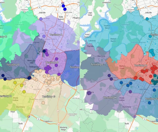
Visualization
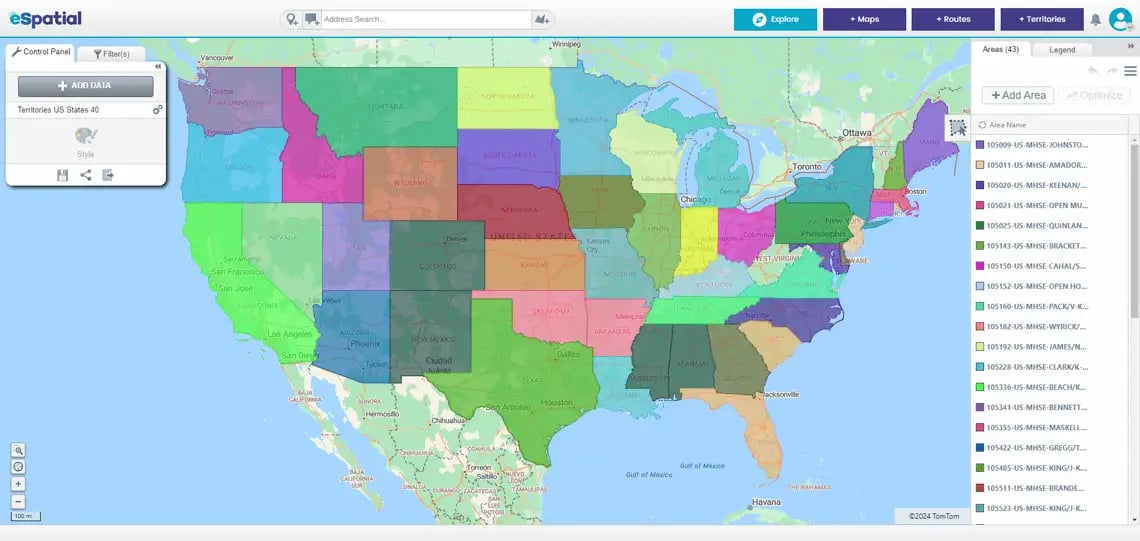
You get visual representations of your territories and associated data, helping you understand the geospatial aspects of different scenarios.

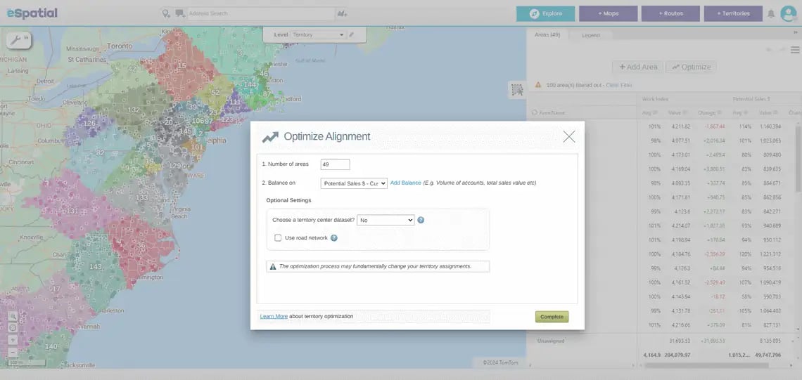
Optimization Algorithms
Advanced tools like eSpatial's territory mapping software incorporate optimization algorithms to automatically suggest or find the most efficient territory configurations based on specified objectives.

Collaboration
Users can collaborate and share scenarios with team members, facilitating group decision-making and communication.
What Are the Use Cases for Scenario Planning?
Scenario planning helps sales leaders make smarter, faster decisions by visualizing and testing territory strategies before taking action. It brings clarity and control, whether you're scaling up, shifting resources, or bracing for seasonal surges.
Use case 1
Rebalancing Sales Territories
Simulate changes in territory boundaries to quickly identify imbalances in workload, revenue, or opportunity. Test new configurations to optimize performance without disrupting your team.
Use case 2
Planning for Growth
or Downsizing
Whether your sales team is expanding or contracting, mapping tools allow you to model the impact of those changes before they happen. You can visualize how to allocate new resources efficiently or absorb responsibilities when headcount shrinks.
Use case 3
Preparing for Seasonal Campaigns
When you create a map with eSpatial, the scenario planning tool helps identify where and when to focus resources during seasonal spikes in demand. By mapping customer locations and potential hotspots, teams can proactively position reps, adjust territory boundaries, or realign support.
How Do You Use the Scenario Planning Tool?
Making changes in eSpatial is simple and intuitive:
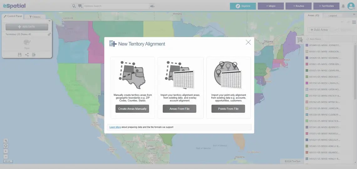
Step 1
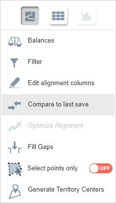
Make your adjustments to your territories. Then click the hamburger icon.

Step 2
Select Compare to last save.
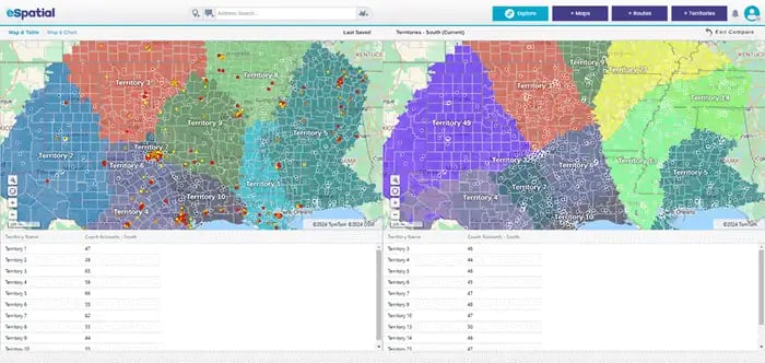
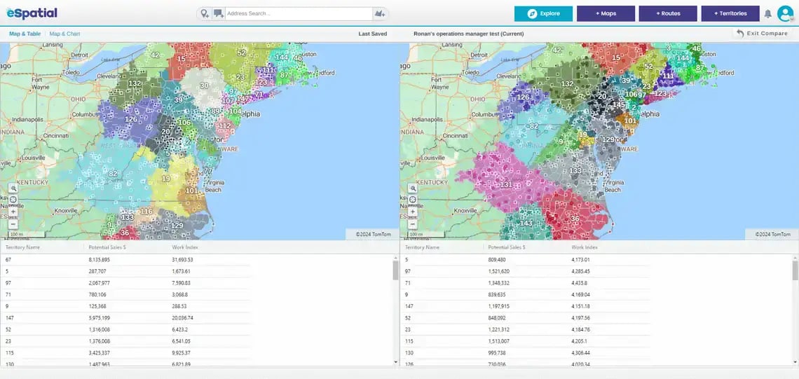
Step 3
The window will display the before and after changes made to your data.

What's Next?
Take your scenario mapping to the next level with tools designed to deepen analysis and refine your plans.
-
The aggregate by value tool instantly calculates totals, such as revenue or opportunity value, within each territory, making it easier to compare plan performance.
Learn more -
The filter tool helps you focus on specific accounts, reps, or criteria, so you can test scenarios for different segments or strategic goals.
Learn more -
The workload index tool measures and balances rep workloads to ensure fair, efficient coverage across all your plans.
Learn more -
The territory center tool plots both geographic and weighted centers for territories. Use this to understand rep positioning, uncover resource placement gaps, and evaluate how territory shifts impact center dynamics.
Learn more