
- Map and analyze customer locations
- Find the perfect location for field personnel to maximize field team resource efficiency
- Optimize, rightsize, or downsize territories to align with scenarios and plan for growth
Our Customers Love Mapping With eSpatial
For Software and Tech Companies Who Want to


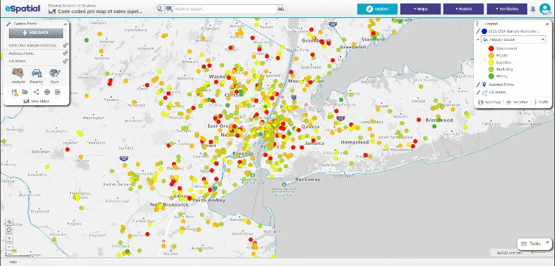
Visualize Your Sales and Customer Data With Interactive Maps
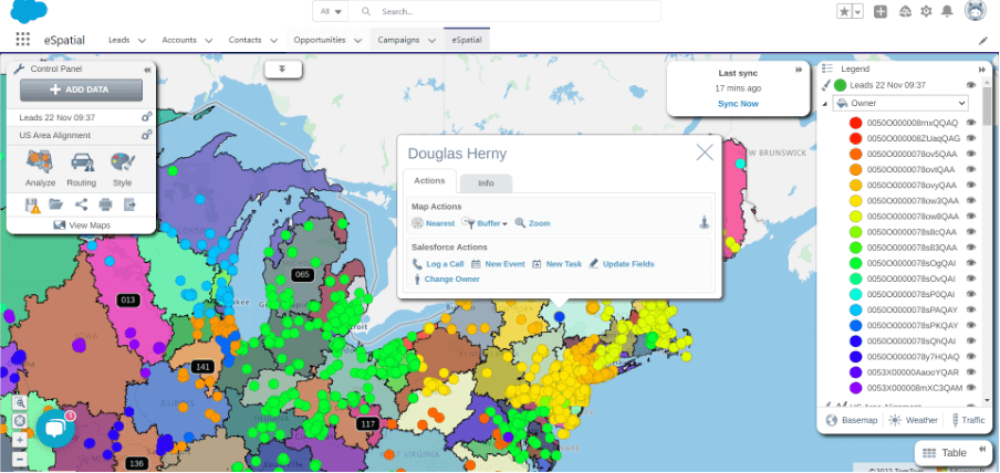
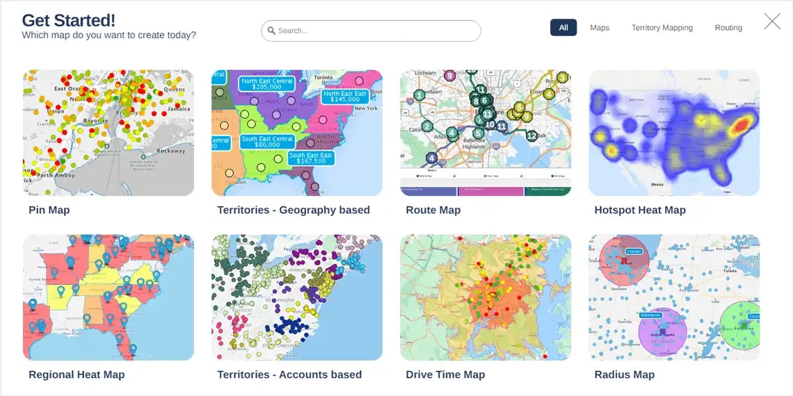
Visualize your critical business data publicly or privately using interactive maps tailored to your needs. These maps help teams identify opportunities and act faster. Use our location data software to turn datasets into clear, strategic visuals that facilitate more informed decision-making. Click the links below to see interactive map examples:
- Staff
- Customers
- Key assets
- Hospitals
- Office locations
- Distribution centers
Perfect Your Hiring Locations & Improve Staff Retention
Find the best hiring locations for field-based staff using our intuitive data mapping software. You can pinpoint where demand meets supply, improving both recruitment and retention. Share this location data with your teams to accelerate onboarding and improve training and development across your personnel.
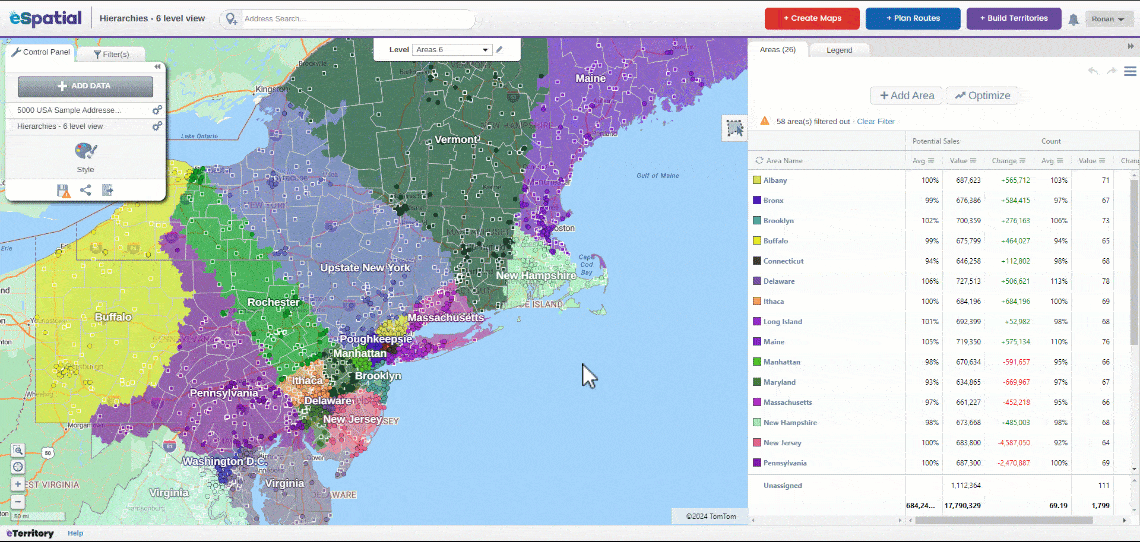
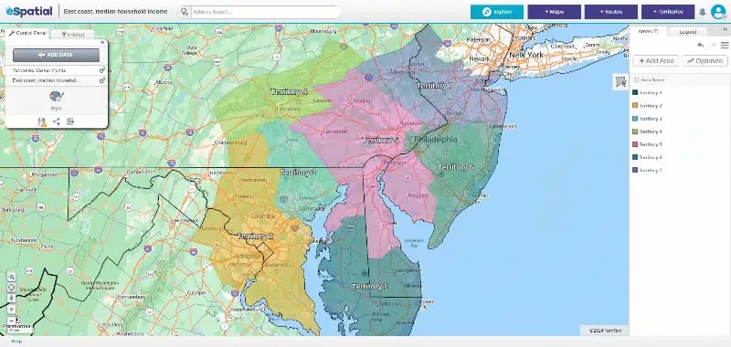
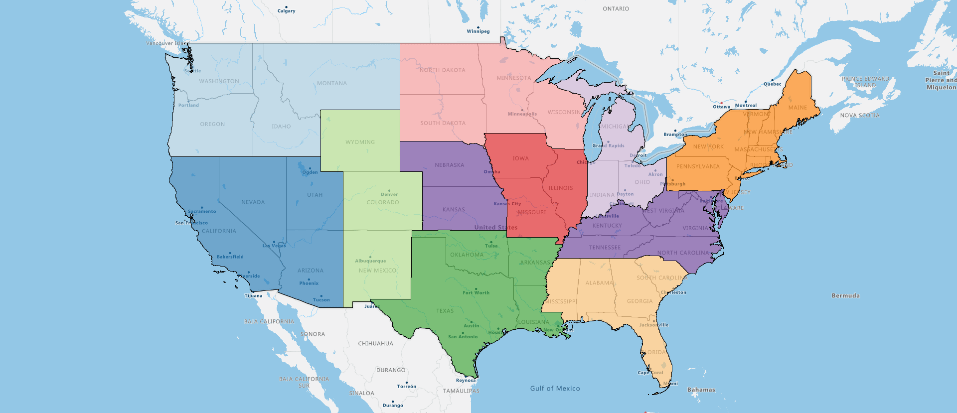
Optimize, Rightsize, or Downsize Territories
The proper territory plan can restore clarity and boost performance for software companies shifting business needs. Our business mapping software empowers you to:
- Optimize sales territories, unlocking new revenue
- Tweak, fine-tune, and move customers or ZIPs quickly
- Share and collaborate with key stakeholders
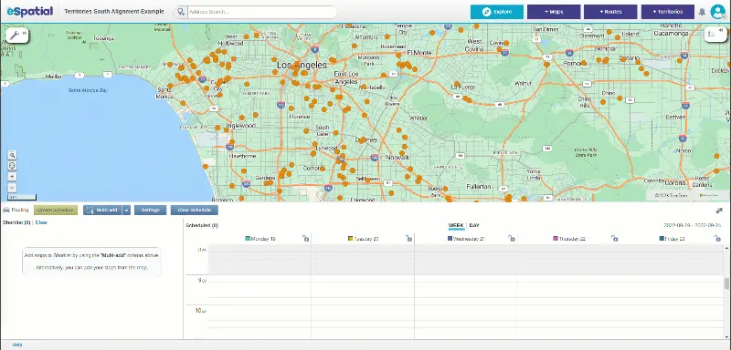

Route Maps With Optimized Schedule on Mobile
Missed meetings and inefficient routing can stall momentum and stunt business growth. Our mobile-ready mapping SaaS software keeps your teams on track and ahead of schedule. Benefits include:
- Add one more sales call a day with optimization
- Maximize time with customers
- Drive costs down


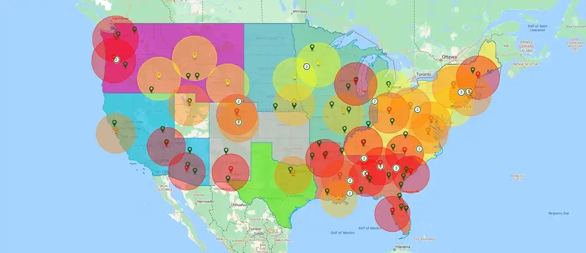
Model Territory & Market Scenarios
Our suite of tools brings spatial awareness to your strategic planning. Assess your potential and clearly map a way forward for your business objectives with advanced features like:
- Heatmaps
- Territory comparison maps
- Color-coded and pin maps
Key Features to Support
Software & Tech Needs
eSpatial’s mapping software for SaaS is built for performance, flexibility, and user empowerment. In the office or on the go, you can access your maps, build insights, and share decisions quickly. Whether using mapping software online or offline, custom styling, mobile optimization, and dynamic selection tools ensure every user gets what they need from the platform.

Seamless Integration
eSpatial integrates with your existing systems, ensuring you can import, visualize, and glean insights from your data without delay. This reduces downtime and maximizes productivity. Your team can start making smarter decisions faster and ensure better use of your resources.
Scalable & Secure Architecture
Whether you have a regional or global distribution mapping network, we’re the solution you need. eSpatial’s scalable and secure platform is designed to grow with your business. Rest assured, your data is protected while your capabilities expand.

Intuitive Interface
eSpatial is designed for quick adoption across your teams with minimal training. Teams can use our geospatial mapping software to map, optimize, and analyze data right away. The user-friendly SaaS mapping platform provides easy access to powerful insights accessible across your organization.
Software and Tech Success Stories
Tech companies use eSpatial’s business mapping software to reduce inefficiencies, manage field resources, and execute strategies effectively. From scaling faster to optimizing operations, results are measurable. Our clients regularly report faster planning cycles, better resource allocation, and improved territory management.


