Radius analysis tool


Streamline your business decisions with geospatial analysis, market research, and route planning using the radius analysis tool

Sign up for a free 14-day trial
Radius analysis of customer locations
What is a radius analysis tool
Video transcript for What is a radius analysis tool

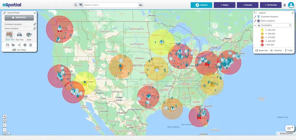
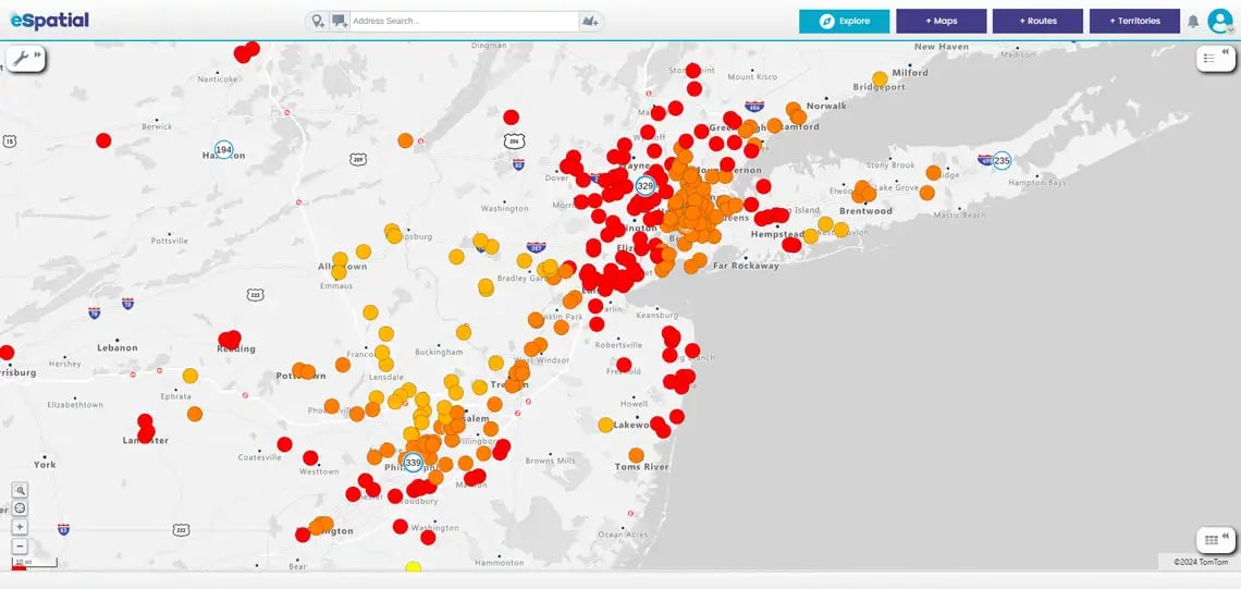
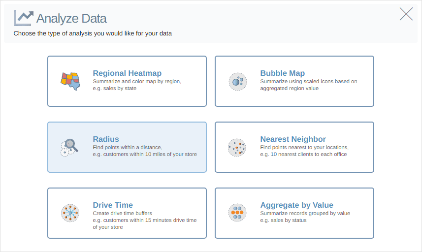
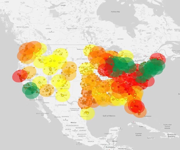
A radius analysis tool allows you to create and analyse areas around a specific point or points.

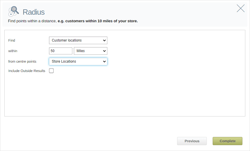
So, for example, here's my location for a distribution center. And I would like to know how many leads or customers are within 10 miles of this particular location.

The radius map allows you see all of those and you can easily export it and do your analysis.


What is a radius analysis tool?

A radius analysis tool allows users to create and analyze areas around a specific point or set of points on a map. Users can specify a central location and define a radius distance; the tool generates a boundary around that location. This feature is helpful in various applications, including:

Geospatial analysis of customers distances to stores

Geospatial analysis


Determine the coverage area or reach of certain assets and facilities, like distribution centers, offices, depots, or retail stores.

Filtering by sum total

Market research


Businesses can use it to identify potential customers or target areas for marketing campaigns based on proximity to their location.

Map of medical facilities

Emergency services


Emergency responders can utilize it to assess the coverage area of fire stations, police stations, or medical facilities.

Route planning tool

Route planning


Operations planners can evaluate transportation networks and routes by analyzing the coverage of stops.

Analyzing location data

Real estate


Real estate professionals can use it to evaluate properties' proximity to amenities like parks, schools, or shopping centers.

How to create a radius analysis

The radius analysis tool is indispensable for decision-making when you rely on spatial data analysis. It is perfect for sales operations, operations, marketing, and data analysts.

Step 1

After adding your 2 datasets to your map. Click Analyze.

Analyze button selected

Step 2

Click the Radius button to add a radius map analysis to your map.

Radius map button

Step 3

Set the distance and the unit of distance measurement between your 2 datasets. Select the From Center Points dataset you wish to use from the drop-down. Click the Complete button

Radius map settings

Step 4

Click the Edit link in the Control Panel to edit your radius analysis.

Click the Clear link in the Control Panel to clear the radius analysis.

Clear/edit analysis links

Step 5

Click the Save as button in the Control Panel to save your radius map.

Save as link

You appear to be offline at the moment, this notice will disappear once your device can connect to the internet again