Our Customers Love Mapping With eSpatial
Why Replace Salesforce Maps?
Salesforce maps software has known limitations that slow teams down, such as:
- A lack of deal tracking capabilities within territories
- It can't show demographic and geographic data together
- Configuration and modification is time-consuming
- The tool isn't user-friendly, especially for new reps
Many users find this software doesn’t keep pace with today’s sales and operations needs. If your workflows depend on mapping, you need a Salesforce Maps alternative that’s intuitive, flexible, and robust.
Salesforce Maps Vs. Other Tools at a Glance
Choosing the right mapping tool depends on features, ease of use, and overall value. This comparison highlights how eSpatial stacks up against Salesforce Maps and other popular alternatives:
|
Feature / Platform |
eSpatial |
Salesforce Maps |
Badger Mapping |
Geopointe |
Maptive |
|
Salesforce Integration |
Seamless |
Native |
Limited |
Native |
Available via We Map Sales |
|
Territory management |
Advanced, dymanic |
Advanced |
Limited |
Moderate |
Basic |
|
Route optimization |
Multi-stop, automated |
Manual in tiers |
Yes (with app) |
Limited |
Yes |
|
Data layering & filtering |
Highly flexible |
Limited |
Moderately flexible |
Yes |
Yes |
|
Analytics & reporting |
Advanced, built in |
Basic |
Basic |
Moderate |
Moderate |
|
Ease of use |
Intuitive, fast setup |
Complex, clunky |
App-based |
Steep learning curve |
Moderate |
|
Pricing |
Transparent, flexible |
High, tiered |
Moderate |
Flexible |
Premium |
|
Support |
Live chats & experts |
Limited ticketing |
Email & resource center |
Live chat & help center |
Live chat & help center |
Key Reasons to Consider An
Alternative to Salesforce Maps
Users often switch from Salesforce Maps because it doesn’t deliver enough value for the cost. Limited Salesforce Maps features, slow setup times, and clunky interfaces lead to frustration. eSpatial eliminates these bottlenecks with an intuitive design, faster performance, and advanced analytics that improve your decision-making.
Reason 1
Cost & Licensing
Restrictions
Salesforce Maps requires costly add-ons, licenses, and upgrades just to access core features like route planning or territory design. These layered costs make scaling expensive and hard to justify. eSpatial offers clear, all-in pricing with access to full functionality from day one.
Reason 2
Limited Data
Integration
Salesforce Maps is restrictive in integrating data sources or layering information from different teams. This makes cross-functional collaboration and full visibility tougher to achieve. eSpatial integrates multiple datasets effortlessly, giving every user the complete picture, and positioning it as a powerful Salesforce Maps alternative for growing businesses.
Reason 3
Clunky UX &
Weak Support
Users frequently cite slow performance, complex setup, and an outdated interface as daily pain points. Support is also limited, with help often delayed or routed through complex ticketing systems. eSpatial solves these issues with a sleek, easy-to-use platform and live expert support, helping your team succeed faster.
All Seamlessly Integrated With Salesforce
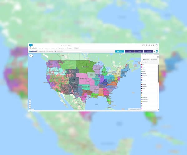
eSpatial for Salesforce is built to give you the full power of a complete mapping software within your Salesforce Org. As a leading Salesforce Maps alternative, it makes geographically visualizing and analyzing your data easier, with seamless data loading of common Salesforce objects, such as leads, opportunities, and custom objects. All the features eSpatial is renowned for are included; like territory management and route optimization, heat mapping, proximity analysis, and map sharing.
Core Capabilities of eSpatial Mapping
eSpatial offers a full suite of advanced mapping tools designed to enhance your Salesforce data. These are the core capabilities that set it apart:
-
Visualize Salesforce data on interactive maps
-
Create, manage, and balance sales territories
-
Optimize multi-stop sales routes with ease
-
Layer multiple datasets (including non-Salesforce data) in your maps and territories for deeper analysis
-
Collaborate on maps in real time
-
Access your full suite anywhere with secure cloud-based tools
-
Get dedicated support team help with initial setup and ongoing support
-
Connect instantly through in-app chat for immediate assistance
Who Uses eSpatial?
Leaders of sales and operations turn to eSpatial when they want to optimize sales rep productivity and revenue but struggle to find a total solution to:
- Discover actionable insights by visualizing and analyzing sales data
- Optimize territory design to increase sales, reduce costs, and enhance resource productivity
- Maximize rep selling time and utilization with advanced routing optimization
Build All the Maps You Need
With a Three-in-one Solution
Giving more data options is useless, unless you can build the maps and workflows you need. The good news is that, with eSpatial, you can do all that and more. eSpatial combines the power of mapping, territories, and routing; all under a single platform.