
Our Customers Love Mapping With eSpatial


Empower Your Financial Analysis
In the dynamic world of financial services, making sense of vast data is critical to success. eSpatial offers a revolutionary approach to data analysis through sophisticated market mapping (GIS) technology. By providing unparalleled insights, we help drive informed decisions, keeping you ahead of the competition.


Visualize Complex Data With Ease
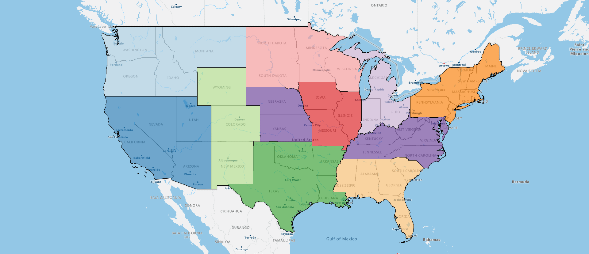
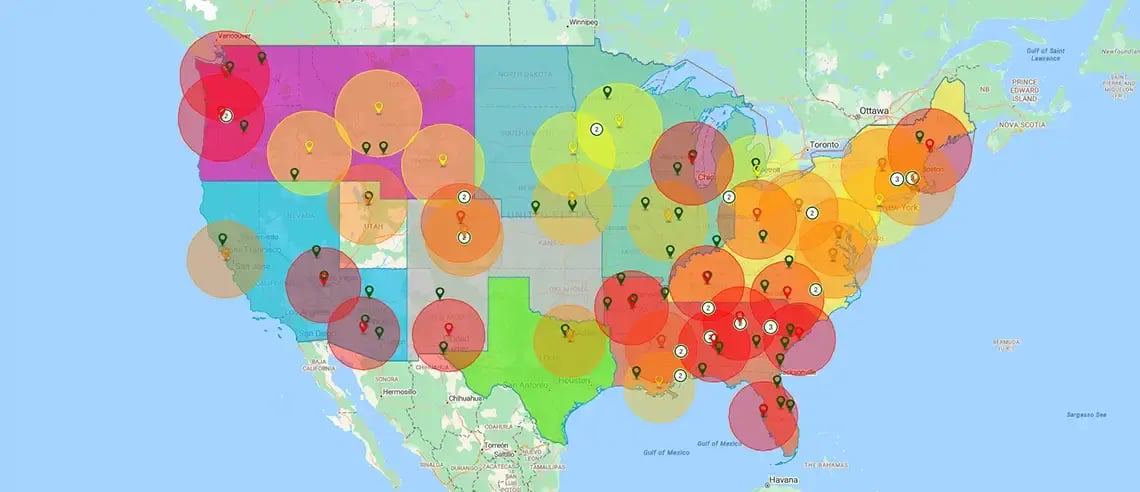
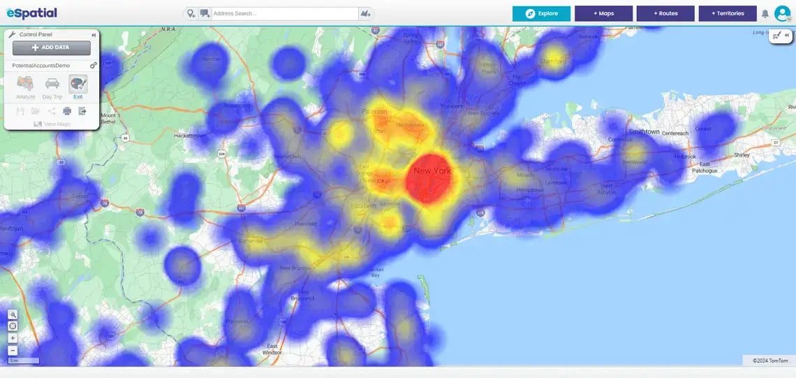
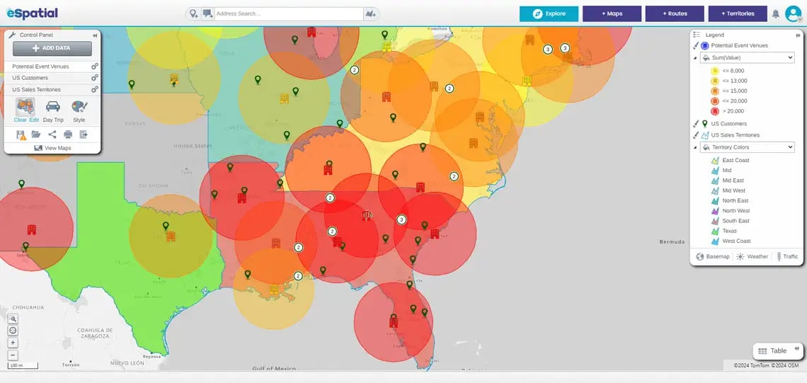
Our cutting-edge market analysis mapping software transforms complex financial data into clear, interactive maps. You can gain a comprehensive understanding of market trends, customer behavior, and risk factors through intuitive visualizations that reveal patterns and relationships at a glance. The process of making complex data bite-sized and digestible facilitates data-driven decisions with greater speed and precision, improving portfolio performance and client outcomes—a vital objective for financial professionals.
- Staff
- Customers
- Key assets
- Insurance claims
- Office locations
Navigate Market Volatility
In today's volatile market environment, agility is essential. eSpatial equips you with the tools to adapt to changing conditions quickly, identify emerging trends, and capitalize on market opportunities before competitors. Market mapping and landscape analysis empower financial services firms to identify opportunities faster, optimize client targeting, make strategic decisions, and deliver improved client service through smarter investments and proactive risk management.
Enhance Client Engagement
Impress your clients with dynamic, interactive maps that bring data to life. Combined with customizable layers and real-time data integration, you can tailor every map analysis to align with your client's requirements. Whether you're presenting investment strategies, risk assessments, or market insights, eSpatial enables you to deliver compelling visualizations that engage, inform, and build trust in your competence as a service provider.

Tailored Solutions for Financial Professionals
From asset managers to insurance companies and financial advisors, eSpatial offers tailored solutions to meet the unique needs of financial services professionals. We cater to a variety of needs, including managing portfolios, analyzing market trends, and optimizing risk management strategies. eSpatial is your trusted partner for data-driven decision-making. Our platform helps your teams collaborate seamlessly on spatial data, streamlining workflows and improving strategic alignment across departments.


