
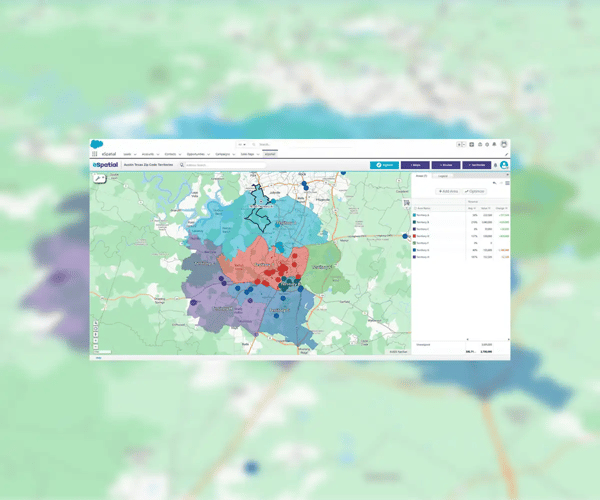
Salesforce Enterprise Territory Management is a built-in CRM feature that allows organizations to assign accounts and opportunities to reps based on customized territory logic. By defining clear regional or strategic boundaries, companies can align reps to high-value areas and streamline operations. To get the most from this tool, many businesses now rely on mapping software for Salesforce data to visualize and manage these territories more effectively.
While implementing territory management in Salesforce, avoid the following common mistakes:
- Assigning reps without considering account density or market size
- Overlapping or redundant territories that confuse ownership
- Not assigning forecast managers to each territory
- Failing to update named account rules regularly
- Underutilizing visualization and spatial data to guide decisions
A strategic, map-based approach reduces these risks and supports smarter decisions. For example, enhance your Salesforce territory planning workflow to enable more precise modeling, faster edits, and stronger reporting.
A full-featured territory management integration, especially one with built-in mapping, allows your team to work faster and more accurately. These features enable organizations to move beyond static CRM workflows. For teams seeking better planning agility, this is the future of territory planning in Salesforce. Explore eSpatial pricing options to see what's possible for your business.
Benefits include
- Map-based editing that shortens planning cycles
- Better account-to-territory alignment using sales and demographic data
- Dynamic forecasting visuals tied to regional goals
- Simplified collaboration between leadership and reps
- Easier onboarding and change management through visual territory maps
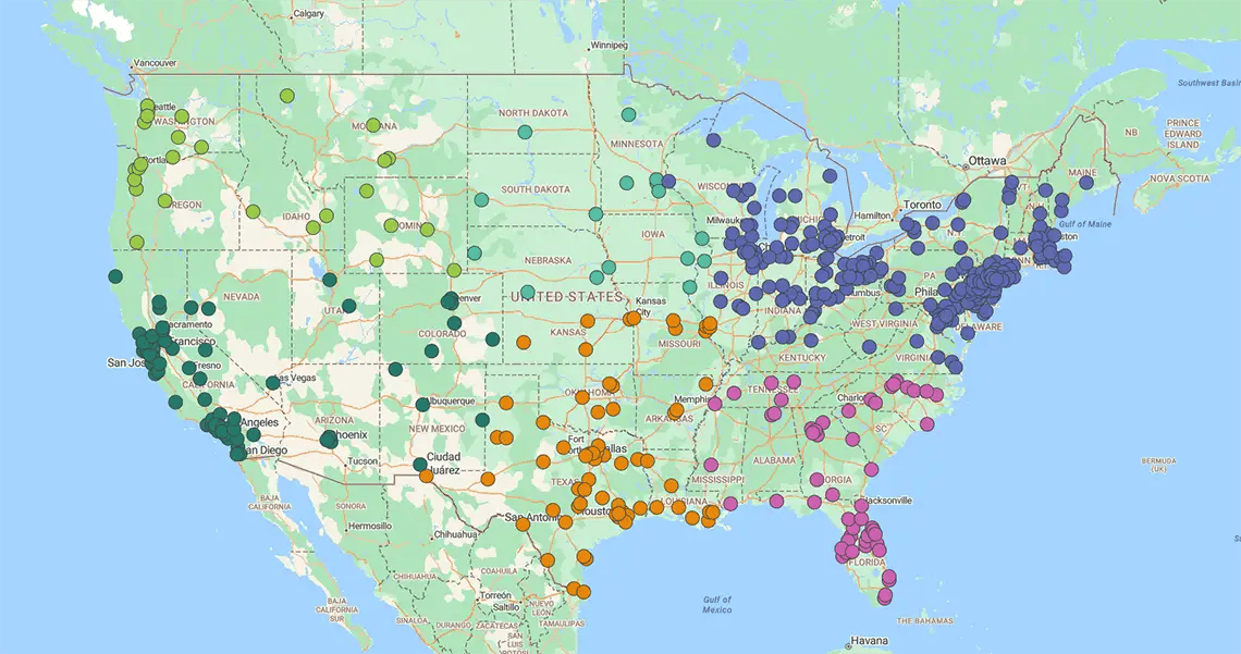
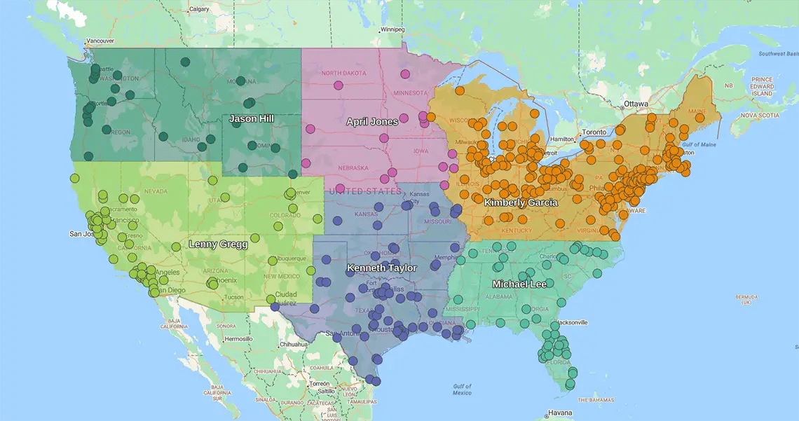
Optimizing sales territories is easy with eSpatial. Simply upload your Salesforce data or spreadsheets, and advanced algorithms automatically generate a vibrant map with geographic information and rich insights. You can draw your territory boundaries from there based on region, ZIP codes, or points. Add visual context with demographic overlays and advanced styling options. As your plans turn to action, eSpatial allows you to monitor sales performance across territories to see what's working and identify areas for improvement.
To help you design better territories in eSpatial, here are a few tips to consider:
1. Prioritize High-value Accounts
Start by assessing the value of each account within your segments. Be sure to identify and prioritize important prospects and customers to target them when it comes time to design your territory.
2. Divide Sales Reps Based on Business Objectives
While you're dividing reps into territories, you'll want to preserve any existing customer relationships. For instance, if one sales rep has worked with a specific client for a while, keeping them in their territory is a good idea to avoid unnecessary disruption.
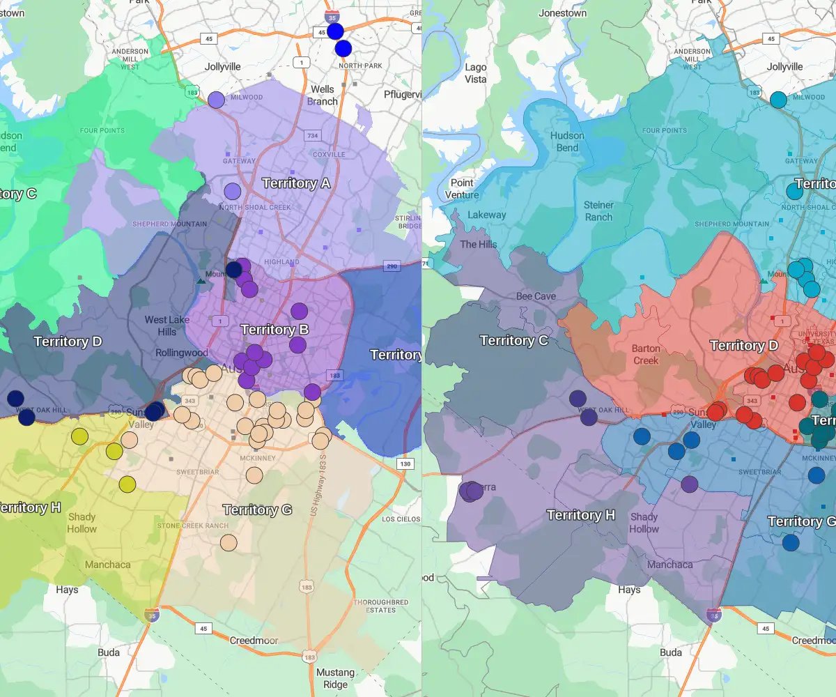
3. Experiment With Territory Design
A sales territory plan doesn't have to be set in stone. As trends and markets change, you'll need to adapt your strategy to match. Be prepared to regularly review your territory plan to realign or balance as needed.

4. Track Territory Performance Over Time
Tracking sales performance between regions is critical to making the right territory management decisions. With a full view of your territory and sales activity, you get deeper insights that can drive efficiency and productivity.