
Quick answer
Proximity is Power
What it is: Nearest neighbor mapping measures the distance between entities—like customers, stores, or assets—to reveal how they relate in space.
The Impact
- Spot patterns: Using spatial analysis see instantly if data is clustered, dispersed, or random
- Target precision: Identify customer clusters for hyper-local marketing campaigns
- Optimize logistics: Place distribution centers efficiently to cut supply chain costs
- Plan growth: Use proximity data to select retail sites and analyze competitor locations
For businesses, knowing where customers are located is just as important as knowing who they are. With today’s mapping software, companies can get a bird’s eye view of customer locations and how they cluster together. It helps identify opportunities for targeted promotions, streamlined operations, and more personal experiences. One powerful tool for gaining customer insights is nearest neighbor mapping.
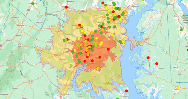
Nearest neighbor mapping goes beyond plotting dots. It calculates the precise distance between entities—like customers or stores—to reveal hidden relationships.
What It Is
- Spatial analysis: It measures who is clustered together and who is isolated
- Trend spotter: It exposes patterns lists miss. For example, it can reveal that customers living near each other share purchasing habits
How It Works
- Calculate: Algorithms (like Euclidean or Manhattan distance) compute the exact space between points
- Identify: The software finds the closest "neighbors" for any given location (e.g., the top 5 nearest customers)
- Visualize: The output is a color-coded map showing connectivity and density
- Differentiate: Unlike basic geocoding, which just maps addresses, this analysis quantifies the relationship between them
5 Ways Nearest Neighbor Maps Drive Value
Visualizing geographic groupings turns raw data into a roadmap for growth.
How to Use it
- Target marketing: Stop spraying and praying. Real estate agents can target the 5 closest homes to a listing; retailers can map the 1,000 nearest customers to a new store for high-impact promotions
- Optimize routes: Cut fuel costs. Map delivery points against warehouses to position distribution centers strategically. Route the 100 nearest deliveries to concentrate drop-offs and save time
- Plan expansion: Plant flags where the people are. Use customer clusters to identify high-demand neighborhoods or commute routes for your next store location
- Source smarter: Match supply to demand. Select suppliers located within key customer clusters to slash transportation costs and speed up fulfillment
- Outmaneuver rivals: Find the gaps. Map competitor locations against your customer base. Spot underserved clusters to win market share where rivals are weak
How to Design a Nearest Neighbor Map
Creating a nearest neighbor map is straightforward with the right data and tools.
The Process
- Define the goal: Know your "why." Are you optimizing store placement or supply chains? Set measurable objectives first
- Select the tech: Don't settle for basic pins. Choose a platform with built-in spatial analytics and nearest neighbor tools
- Clean the data: Garbage in, garbage out. Standardize addresses to ensure the calculator measures distance accurately
- Set parameters: Configure your metrics. Select distance thresholds and drive times that reflect real-world travel
- Analyze and act: Spot the patterns. Annotate key findings and export the visualization to drive stakeholder decisions
Start Growing Now
Don't view customers in isolation. Use nearest neighbor insights to plan locations, optimize routes, and uncover cross-selling opportunities instantly.
- The solution: eSpatial turns complex spatial analytics into a guided workflow
- What to do: Check out our territory mapping software and start discovering hidden patterns in your data today