

• Data visualization

How to Map Employee Locations for Resource Optimization


Without visual data, location decisions waste space, inflate travel, and misalign teams. Workforce mapping gives leaders strategic oversight of employee density and coverage.

Liam Costello
  • Published: April 10, 2023
  • Updated: September 25, 2026
  • Author: Liam Costello
  • Reading time: 10 mins
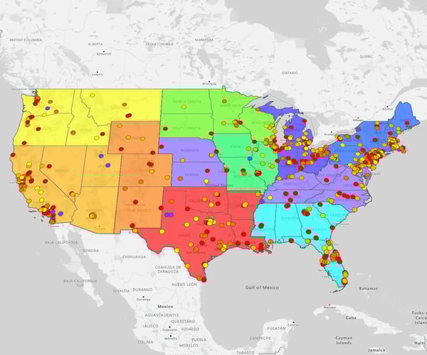
Territory map with pins overlaid

Quick answer

How Can You Map Employee Locations
for Maximum Resource Optimization?

Visualizing employee locations turns static address lists into strategic spatial intelligence for real estate, logistics, and field resource optimization. By moving beyond spreadsheets to interactive maps, teams can instantly identify geographic clusters, coverage gaps, and routing opportunities that streamline operations and lower costs.

When teams rely solely on flat spreadsheets, crucial geographic insights stay buried in rows and columns. Plotting workforce addresses on an interactive map immediately surfaces spatial patterns that drive smarter decisions across your entire enterprise.

The Operational Impact

  • Streamline planning: Use real-world workforce distribution data to make confident decisions on office spaces, lease renewals, facility closures, or regional hub expansions
  • Optimize territories: Align sales and service assignments based on where staff actually live and work to reduce travel time and transit costs
  • Boost cohesion & culture: Identify local employee clusters to connect remote workers, encourage cross-departmental collaboration, and strengthen company culture

Why Is Employee Location Mapping
Critical for Strategic Operations?


Employee location mapping is critical because it replaces guesswork with precise geographic intelligence for key business decisions. Visualizing staff addresses helps companies optimize operational territories, identify ideal sites for new offices or depots, reduce travel overhead, and ensure employee safety during emergencies.

Relying on intuition or static address files makes it difficult to uncover hidden inefficiencies in field coverage and workplace strategy. Mapping your team’s real-world footprint gives leadership instant visual clarity on how resources are spread across regions. By connecting workforce address data to dynamic visual maps, you can immediately realign sales and service routes, eliminate overlapping jurisdictions, and lower commuting and travel expenses.
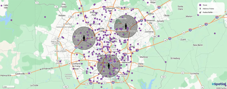
Pin map, with radius overlay

Transforming employee address lists into clear visual layers generates concrete returns across multiple business functions:

  • Visualize Real-World Distribution: Instantly spot workforce clusters, coverage gaps, and remote work patterns directly from your existing spreadsheets
  • Support Data-Backed Decisions: Optimize sales and service territories to eliminate redundant overlap, position new facilities near staff, and reduce ongoing operating expenses
  • Enhance Safety & Cohesion: Build travel-efficient schedules that protect work-life balance and locate staff rapidly to coordinate support during unforeseen emergencies

How Does Location Mapping Drive
Strategic Enterprise Decisions?


Location mapping turns static employee address data into visual intelligence that guides C-suite real estate consolidation, M&A integration, and workforce expansion. It helps leadership align physical office investments with true staff density, accelerate targeted talent acquisition, and instantly manage duty-of-care emergency risks.

Relying on address lists alone leaves executive leadership blind to macro-level workforce shifts. Spatial intelligence bridges the gap between high-level operational goals and day-to-day employee distribution.
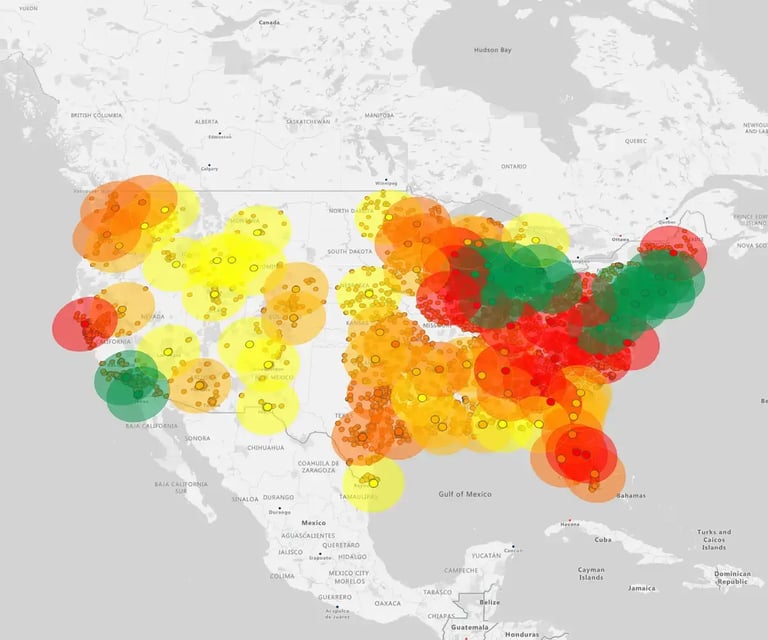
Radius map, USA

How Does Location Mapping Drive C-Suite
Real Estate and M&A Decisions?

During corporate restructuring or post-merger integrations, mapping combined workforce footprints prevents multi-million dollar real estate missteps:

  • Lease Rationalization: Overlay office lease expiration dates against employee residence heat maps to identify underutilized facilities and confidently consolidate workspace
  • M&A Footprint Unification: Plot acquired teams alongside existing facility networks to consolidate overlapping regional offices without disrupting core operational groups
  • Portfolio Optimization: Lower fixed overhead by replacing underused central offices with strategically placed flex-hubs aligned with actual employee proximity
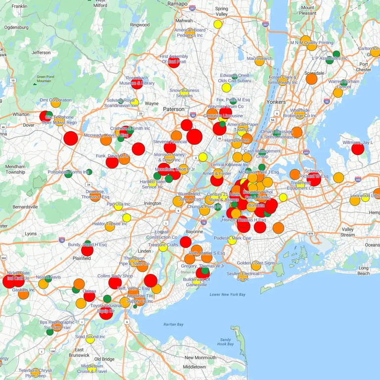
Pins highlighting concentrations

How Does Spatial Intelligence Accelerate
Recruitment and Talent Sourcing?

Recruiting in expensive metro markets without location context leads to higher hiring costs and longer fill times:

  • Organic Hub Identification: Spot where remote employee clusters naturally form to establish low-cost regional micro-hubs
  • Targeted Candidate Sourcing: Focus recruitment campaigns in areas where existing staff density provides built-in culture, peer mentorship, and onboarding support
  • Time-to-Fill Reduction: Align regional growth plans with verified talent pools to streamline local onboarding cycles
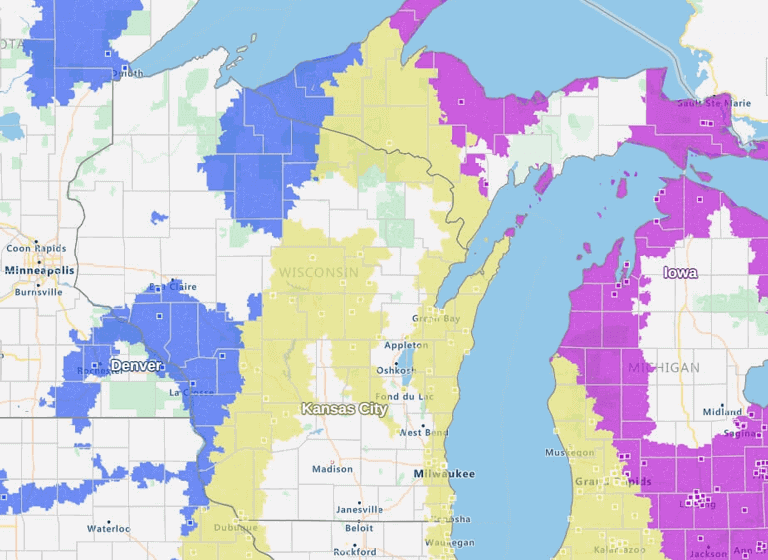
Coverage gap analysis

How Do You Ensure Emergency Duty of
Care and Tax Compliance via Maps?

Knowing exactly where your distributed staff is based is vital for corporate governance, safety compliance, and employee wellbeing:

  • Rapid Crisis Mapping: Apply instant radius filters during severe weather or geopolitical emergencies to locate and contact impacted staff immediately
  • Multi-State Tax & Payroll Compliance: Track where remote staff actually reside to ensure your business pays the correct local payroll taxes and complies with state-specific labor laws
  • Smarter Scheduling: Design balanced coverage zones that reduce transit burnout and support a healthy work-life balance

What Data Do You Need to Map
Employee Locations Effectively?


To map employee locations effectively, you only need structured spreadsheets with basic contact details and reliable address data. Using separate files for home and work addresses allows mapping tools to easily overlay both layers on a single map.

Starting an employee mapping project does not require complex database integrations or specialized IT support. All you need to begin is a clean, organized address list from your HR software.

Recommended Data Setup:

  • File 1, Home Addresses: Keep staff residential location data in a dedicated spreadsheet for commute analysis, remote work planning, and emergency response.
  • File 2, Work Locations: Keep office, facility, depot, or client site addresses in a second spreadsheet to measure team proximity and coverage.

Using two separate files makes it easy to upload and overlay multiple data layers on the same interactive map, giving you a clear visual comparison of staff residences against company facilities.

Pro-Tip: If you prefer to keep all your data in a single spreadsheet file, simply add a column labeled "Location Type" and designate each row as either "Work" or "Home".

What Are the Recommended Data Fields for Mapping?

Including the right attributes in your spreadsheet helps you filter and analyze your workforce map with precision:

Employee Name

Identifies individual pins on the map for quick record lookup.

Contact Details

Includes email address and phone number for direct communication directly from map pin cards.

Department
or Team

Enables functional group filtering across regions (e.g., Service, Sales, Engineering).

Job Title

Helps evaluate specialized role distribution across regional markets.

Work Model

Categorizes employees by work arrangement (Office, Hybrid, Remote).

Street Address,
City, State, & ZIP Code

Provides the essential location data needed for precise geographic geocoding.

A 5-Step Guide to Mapping
Employee Locations


The 5-step process for mapping your workforce footprint involves gathering clean address data, choosing the right mapping tool, uploading spreadsheets with customized pins, filtering to analyze regional patterns, and converting spatial insights into real estate and operational strategies.

Transforming raw employee lists into an interactive map is a quick, straightforward process. Following five practical steps allows you to move from basic spreadsheets to strategic spatial intelligence in minutes.

1
Step 1

Collect and Clean Your Data

Gather your workforce address data from your HR system into structured spreadsheets. Cleaning missing postal codes and standardizing state abbreviations ensures accurate geocoding when plotting pins on your map.

2
Step 2

Choose the Right Mapping Tool

Match your visualization style to your specific business goals:

  • Pin Maps: Display individual employee locations for simple directory lookups and local team connections
  • Heat Maps: Highlight high-density talent clusters and regional concentration patterns
  • Territory Maps: Balance workload distribution and assign field operations staff evenly across regions
  • Radius Maps: Measure commute buffers and proximity around existing or proposed office locations
3
Step 3

Upload Data and Customize Pins

Import your spreadsheets directly into your mapping software. Customizing map pins by color, shape, or symbol based on department, job role, or work model makes complex spatial trends instantly clear.

4
Step 4

Apply Filters and Analyze Patterns

Use dynamic filters to segment your workforce data and uncover actionable operational insights:

  • Filter by department or role to spot local coverage gaps and overlapping service boundaries
  • Segment remote staff to identify natural geographic hubs for prospective flexible workspaces
  • Select any map pin to view detailed employee information, including role, team, and contact details

Read more about filtering.

5
Step 5

Translate Map Insights into Strategic Action

Share interactive visual maps with executive leadership, HR, and operations teams to execute data-backed strategies:

  • Consolidate underused office facilities located near overlapping employee clusters
  • Rebalance sales and service territory boundaries to minimize commute times and travel expenses
  • Establish low-cost regional hubs to strengthen culture and support hybrid workers

Which Employee Location Mapping
Software Is Best for Your Business?


The best mapping software depends on your operational focus: dedicated business mapping platforms excel at strategic planning and territory optimization, GPS tracking apps manage active field fleets, office booking software coordinates hybrid hot-desking, and spreadsheets offer basic static snapshots.

Different mapping tools serve distinct operational needs across an enterprise. Matching software capabilities to your primary business objective ensures you select the right tool for your workforce.
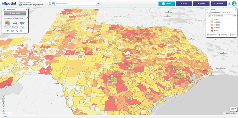
Texas heat map

Dedicated Business Mapping Platforms, e.g., eSpatial

  • Best For: Enterprise strategic workforce planning, territory balancing, real estate footprint rationalization, and CRM/HRIS address mapping
  • Key Capabilities: Automated batch geocoding, multi-layer dataset overlays, drive-time radius analytics, scenario modeling, and territory optimization

Real-Time GPS Tracking Apps, Field Operations

  • Best For: Active routing, live dispatch, and real-time monitoring of mobile service crews and field service staff
  • Key Capabilities: Live GPS tracking, route optimization, time-on-site logging, and automated job dispatching

Office Floor Plan & Desk Booking Software

  • Best For: Managing hybrid office layouts, hot-desking reservations, and daily in-office space utilization
  • Key Capabilities: Interactive floor plan mapping, desk booking, room reservation, and in-office colleague locating

DIY Spreadsheets

  • Best For: Small teams needing a simple, one-off visual snapshot of basic employee locations
  • Limitations: Flat spreadsheets lack dynamic HRIS syncing, automated territory balancing, radius analytics, and the scalability required for growing organizations


Key Takeaways on Mapping
Employee Locations


Strategic Action

Visualizing employee addresses turns passive contact lists into actionable spatial intelligence for real estate, hiring, and field logistics.

Immediate Value

Efficiency gains are generated immediately, whether you upload simple spreadsheets or connect enterprise HR platforms directly.

Clear Return on Investment

Dedicated business mapping software delivers rapid ROI through lower travel expenses, optimized real estate commitments, and faster recruitment cycles.


Find the Right Mapping Solution


Contact our mapping experts to see how eSpatial fits your organization's workforce strategy.

Frequently Asked Questions


Employee location mapping is the visual representation of workforce geographic distribution on interactive maps. It transforms static HR address spreadsheets into visual spatial intelligence, helping businesses optimize office footprints, reduce travel expenses, manage regional territories, and ensure employee duty-of-care protection.

You can map employee locations by exporting a clean address file from your HR system and uploading it directly into a business mapping platform like eSpatial. The software automatically geocodes street addresses or postal codes into map pins, allowing you to color-code by department, apply filters, and analyze regional clusters.

Dedicated business mapping platforms analyze aggregated address data for strategic planning, office lease decisions, and territory optimization. In contrast, real-time GPS tracking apps monitor the live physical locations and movements of mobile field service technicians and delivery drivers.

By overlaying employee residential address heat maps with facility locations and lease expiration dates, leadership can identify underutilized offices. This visual data allows companies to consolidate redundant sites, open flex-hubs near staff clusters, and rationalize real estate costs.

Yes. During unexpected severe weather events or geopolitical crises, administrators can apply radius filters on an interactive map to instantly identify all employees residing in the affected area, ensuring rapid communication and duty-of-care support.

You appear to be offline at the moment, this notice will disappear once your device can connect to the internet again