
Geographic Information Systems (GIS) and business mapping software (such as eSpatial) both use maps, but they're designed to solve very different problems. While they may appear similar at first glance, the people who use them, the questions they answer, and the outcomes they deliver are fundamentally different. Choosing the wrong platform can leave your team paying for capabilities they'll never use or struggling with software that's far more complex than their day-to-day work requires.
This guide explains the key differences between GIS and business mapping software, the types of organizations each is designed for, and the business problems they solve. By the end, you'll have a clear understanding of which solution best fits your team's workflows, whether you're managing sales territories, coordinating field operations, or tackling complex geographic analysis.
The Fundamental Difference: GIS is for Analysis; Business Mapping is for Operations
"We need GIS for territory management." It's one of the most common things we hear from businesses shopping for mapping software, and it's almost always the wrong starting point. The mistake makes sense. When you picture managing territories or tracking field teams, you picture a map. And GIS platforms are, without question, mapping software. So the logic seems to follow: if I want a map, I need GIS.
But wanting to see something on a map and needing to analyze it geographically are two different things. Geographic Information Systems are built for spatial analysis. They collect, store, and process complex geographic data at scale, helping specialists (e.g. utility companies and engineering firms) uncover patterns, model scenarios, and answer technical questions about the physical world.
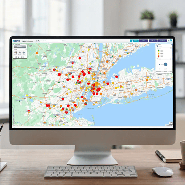
Business mapping software solves a different problem. It's not there to analyze the physical world. It's there to help operational teams move faster day to day. Sales ops uses it to divide customer accounts into territories. Field service uses it to plan efficient routes. Logistics uses it to spot coverage gaps at a glance. It just requires a clear, usable map.
GIS answers complex research questions. Business mapping software answers operational ones. So the real question isn't "do we need maps?" It's "do we need analysis or operations?" Studying environmental change or infrastructure calls for GIS. Managing territories, customers, or field teams calls for business mapping software, with far less complexity and a much smaller learning curve. The table below highlights the key differences between GIS and business mapping software.
|
Dimension |
GIS (Geographic Information Systems) |
Business Mapping Software |
|
Purpose |
Analyze and process spatial data to identify patterns, model outcomes, and solve complex geographic problems. |
Visualize and manage business operations, assign territories, optimize routes, and improve operational decision-making. |
|
Primary users |
GIS specialists, spatial analysts, environmental scientists, urban planners, utilities, government agencies. |
Sales operations managers, field service supervisors, logistics coordinators, insurance teams, real estate professionals. No GIS expertise required. |
|
Typical output |
Research reports, predictive models, environmental assessments, infrastructure planning, spatial analysis, statistical findings. |
Territory assignments, optimized routes, customer coverage plans, workload-balanced rep coverage, operational dashboards, real-time field activity maps. |
|
Typical investment |
GIS software plus specialist expertise and training. |
Business mapping software used by existing operational teams without specialist GIS knowledge. |
|
Time to first output |
Often weeks or months, depending on data preparation, analysis, and project complexity. |
Typically days or weeks, with data imported from CRM or spreadsheets and operational maps created quickly. |
What GIS is Designed For Why Most Businesses Don't Need It
GIS platforms are far more than digital mapping tools: they're a discipline built around collecting, managing, analyzing, and visualizing spatial data. Organizations use GIS to answer complex geographic questions, identify patterns, and model how places and environments change over time.
A modern GIS platform can process satellite imagery (raster analysis), analyze roads, boundaries, and utilities (vector processing), transform data between different coordinate systems, perform spatial statistics, and model networks such as roads, pipelines, or power grids. These capabilities help specialists understand not just where something is, but why it's happening and what might happen next.
That's why GIS is widely used by government agencies, utilities, environmental organizations, engineering firms, research institutions, and urban planners. These organizations often need to predict flood risk, analyze land use, plan infrastructure, manage natural resources, or assess environmental impact. Their output is typically a research report, planning document, or predictive model rather than a day-to-day operational workflow.
Why Sales Teams Buy GIS And Regret It
Businesses evaluating mapping software often assume that because GIS can display maps, it's automatically the best solution for business operations. In reality, sales and field teams usually have a very different problem to solve.
Confusing "Has Maps" With "Is Mapping Software"
A sales operations manager wants to visualize customer accounts, assign territories, or optimize routes. Procurement sees that ArcGIS includes mapping capabilities and assumes it meets the requirement. The result is a platform built for spatial analysis rather than operational territory management, leaving teams with far more functionality than they actually need.
If your goal is to manage sales territories rather than analyze geographic data, a business mapping platform like eSpatial is designed for the job. It helps operational teams assign accounts, optimize routes, and manage territories without the complexity of a full GIS platform.
Hiring a GIS Analyst When a Sales Ops Person Would Do
GIS platforms are built for trained practitioners who understand spatial data, coordinate systems, and advanced analysis. In the U.S., according to current estimates, a GIS analyst costs $60,000 to $90,000 a year, plus roughly six months to get up to speed on your CRM and sales process. Business mapping software puts the same territory-planning work in the hands of the sales ops team you already have, for $500 to $7,000 in software costs.
Building In GIS When The Real Question Is Operational
GIS and business mapping software are built to answer very different kinds of questions, on very different timelines. "Which neighborhoods face the highest flood risk?" is a GIS question, and it can reasonably take around 12 weeks of analysis to answer properly.
"How should we assign these accounts across six reps?" is an operational question, and it shouldn't take a research process to solve. With business mapping software, that answer takes about 2 hours, and is designed specifically for those day-to-day decisions.
What Business Mapping
Software is Designed For Why It's Right for Most Organizations
Business mapping software is built for operational teams that need to make location-based decisions quickly. It helps organizations visualize customers, assign accounts, manage territories, optimize routes, and coordinate field activities using interactive maps. This makes business mapping software a natural fit for sales operations, field service, logistics, insurance, and real estate teams. Instead of relying on GIS specialists, these platforms are designed for the people already managing day-to-day operations. Sales managers can balance territories, dispatch teams can improve route efficiency, and field supervisors can monitor customer coverage without needing advanced spatial analysis skills.
Another key advantage is integration. Many business mapping platforms connect directly with CRM systems such as Salesforce, HubSpot, and Microsoft Dynamics, allowing operational teams to work from current customer and account data. Territories can be updated as the business changes, helping sales and field teams stay aligned with live operational information rather than static spreadsheets.
The output is practical and immediate. Instead of generating research reports or predictive models, business mapping software creates operational tools teams use every day: territories that assign accounts to reps in real time, optimized routes, and live maps showing customer coverage and field activity. And because there's no specialist required, the cost reflects it. Business mapping software can run at around a tenth of the cost of a GIS analyst, with the software itself priced for operational teams, not research departments. The table below highlights the capabilities that define business mapping software and where it differs from a traditional GIS platform.
|
Feature Category |
Capability |
What This Means |
|
Territory Design |
Yes |
Create and optimize territories, assign accounts, and visualize geographic coverage. |
|
Scenario Modeling |
Yes |
Test multiple territory configurations before committing; compare side-by-side to see which balances best |
|
Raster Analysis |
No |
Cannot process satellite imagery, gridded data, or statistical spatial analysis. This is a GIS function. |
|
Route Optimization |
Yes |
Plan efficient routes for field visits, minimize travel time, assign stops to technicians or reps. |
|
Environmental Prediction Modeling |
No |
Environmental and scientific modelling requires GIS software. |
|
CRM Integration |
Yes |
Connect to Salesforce, HubSpot, Microsoft Dynamics, and other CRM platforms to work from live customer data. Writes territory assignments back. |
|
Coordinate System Transformation |
No (not needed) |
Business mapping software uses standard geographic coordinates, removing the need for specialist GIS knowledge. |
Decision Framework: Do You
Need GIS or Business Mapping?
Choosing between GIS and business mapping software depends on the problem you're trying to solve. Are you analyzing geographic data to answer complex spatial questions, or are you managing day-to-day business operations? Or both? The scenarios below can help point you in the right direction.
Spatial Analysis: You Need GIS
If your work involves understanding geographic patterns, predicting future outcomes, or processing complex spatial datasets, GIS is the right choice. These projects typically require specialist knowledge and advanced analytical capabilities that go well beyond everyday business mapping.
Typical questions include:
- Which neighborhoods are at the highest risk of flooding?
- How will climate change affect soil composition across 50,000 acres?
- Which underground utility cables are most likely to fail based on age, soil conditions, and maintenance history?
These are analytical questions that rely on satellite imagery, spatial statistics, network analysis, or predictive modelling. The output is usually a report, model, or planning recommendation that supports long-term decision-making.
Operations Management: You Need Business Mapping
If your priority is assigning people to geographic areas, balancing workloads, planning routes, or managing customer coverage, business mapping software is the better fit. Rather than analyzing spatial patterns, these platforms help operational teams make faster, better-informed decisions using live business data.
Typical questions include:
- How do we assign 1,000 customer accounts fairly across 50 sales representatives?
- What's the most efficient route for 20 field technicians completing 15 visits each day?
- How can insurance producers or sales representatives view their assigned territories on an interactive map?
These are operational questions. You're managing people, customers, and territories, not conducting geographic research. Platforms such as eSpatial are designed specifically for these workflows, helping sales and field teams create balanced territories, optimize routes, and work from live CRM data without the complexity of a full GIS platform.
Enterprise Planning and Field Operations: You May Need Both
Some organizations benefit from using both GIS and business mapping software because they solve different problems within the same business. GIS supports strategic planning and spatial analysis, while business mapping software helps operational teams manage territories, routes, and customer coverage.
Typical examples include:
- A utility company uses GIS to model flood risk and plan future infrastructure, while field teams use business mapping software to assign maintenance territories and optimize daily service routes
- An insurance provider assesses regional risk using GIS but manages producer territories and customer assignments through business mapping software
In cases like this the two platforms complement one another, allowing different teams to work with the tools best suited to their responsibilities.
GIS vs. Business Mapping Software: Side-by-Side Comparison
The comparison below summarizes the key differences between business mapping software and GIS platforms at a glance.
|
Feature/Capability |
GIS |
Business Mapping |
Notes |
Analysis & Data Processing |
|||
|
Raster Analysis (satellite imagery, grids, continuous surfaces) |
Yes |
No |
GIS processes satellite imagery, elevation, and climate data. Not needed for business operations. |
|
Vector Processing (shapefiles, layers, discrete objects) |
✓ Yes |
Limited |
GIS supports complex shapefile processing. Business mapping software works with points, boundaries, and territories, not sophisticated layer analysis. |
|
Spatial Statistics & Spatial Queries |
Yes |
Limited |
GIS analyzes spatial relationships and geographic patterns. Business mapping software does offer it but it is more limited in scope. |
|
Coordinate System Transformation (UTM, State Plane, etc.) |
Yes |
No |
GIS manages multiple coordinate systems. Business mapping software uses standard geographic coordinates – no conversion needed. |
|
Environmental & Scientific Modeling |
Yes |
No |
Flood modelling, climate analysis, and environmental assessments are core GIS applications. |
|
Predictive & Statistical Modeling |
Yes |
Limited |
GIS supports advanced predictive modelling. Business mapping software does simple “if this, then that” scenario testing, not prediction. |
Business Operations |
|||
|
Territory Design & Management |
No |
Yes |
Business mapping software’s core feature is to create territories, assign accounts, and support day-to-day sales and field operations. |
|
Scenario Modeling (test configs before deploying) |
Yes |
Yes |
Key business mapping feature. Test "What if Rep A gets Territory 1?" before committing. |
|
Route Optimization & Planning |
No |
Yes |
Optimize routes for sales representatives, technicians, and field teams to reduce travel time and improve efficiency. |
|
Workload Balancing |
No |
Yes |
Balance territories using factors such as account value, drive time, customer density, or representative capacity. GIS is not designed for this. |
|
Native CRM Integration |
No |
Yes |
Essential business mapping feature that provides two-way sync with live CRM data (Salesforce, HubSpot, Microsoft Dynamics). GIS requires manual data export/import. |
|
Mobile Field Visibility |
Yes |
Yes |
Business mapping tools have mobile apps. |
|
Live Operational Dashboards |
No |
Yes |
Real-time dashboards provide visibility into territories, customer coverage, and operational performance. Possible in GIS but requires specialized solution. |