4.8/5 of 53 reviews
4.3/5 of 38 reviews

How Can Business Mapping Software Unlock Hidden Revenue and Field Growth?


Static CRM spreadsheets hide high-growth revenue pockets, but visualizing location data turns day-to-day decision friction into strategic clarity, giving Sales, Field Operations and Marketing teams a shared visual path to uncover new market opportunities, optimize territories and routes, and drive growth.

Transform your data into presentation ready maps

Our Customers Love Mapping With eSpatial

  • RE/MAX logo
  • FedEx logo
  • Volvo logo
  • LG Electronics logo
  • Henkel Corporation logo
  • Continental Tire logo

Why Is a 3-Stage Mapping Intelligence Process
Critical for Sales, Marketing & Operations?


A 3-Stage Mapping Intelligence Process connects mapping, territory balancing, and route optimization into a continuous highly effective operational workflow. Unlike isolated mapping software tools, an integrated engine aligns cross-functional teams, eliminates manual planning friction, and boosts field productivity from initial insights to daily rep execution.

Never treat location intelligence as piecemeal tools: mapping software for visualization, territory mapping software for yearly territory planning, and a standalone route planning tool for route optimization. A fragmented strategy creates unnecessary friction, misaligned teams, and wasted operational and execution time.

The 3-Stage Mapping Intelligence Process is Seamless

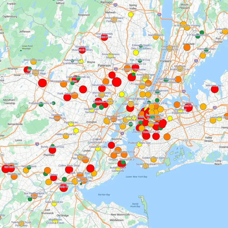
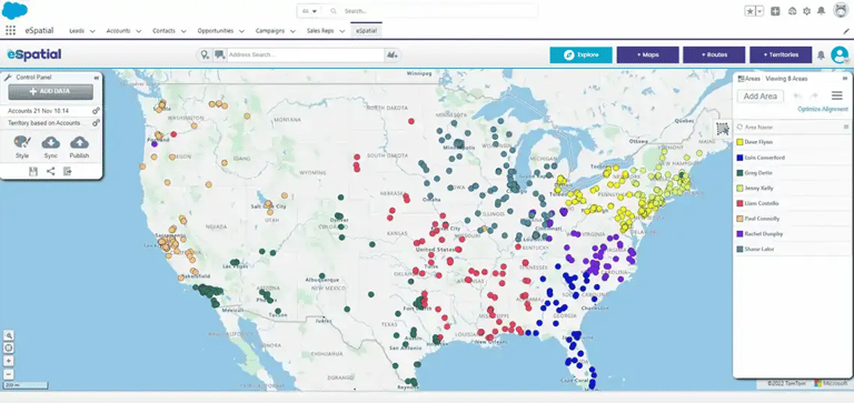
pin-map-higlighting-low-revenue-concentrations

Stage 1: Mapping Discover & Align

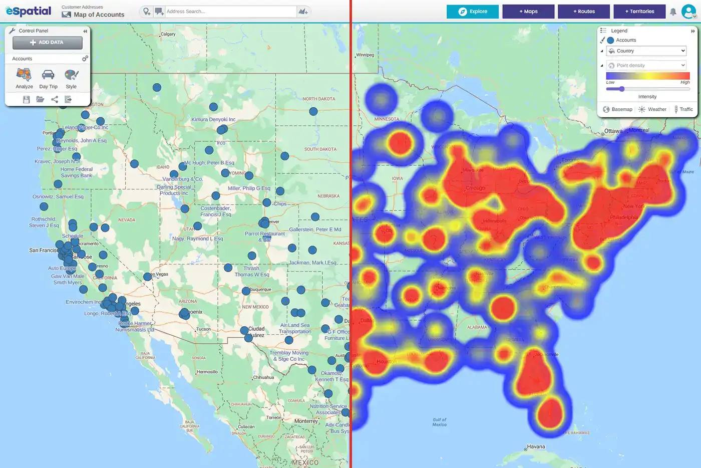
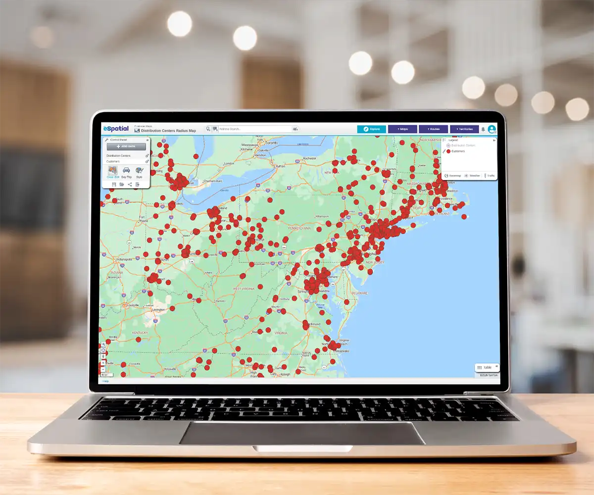
Transform CRM location data into interactive maps to reveal hidden account density, regional gaps or whitespaces, and growth opportunities. Teams build early consensus using live interactive maps rather than static rows. Put simply you'll see the trends, pockets of opportunity and areas for exploration, which build your foundation for growth.

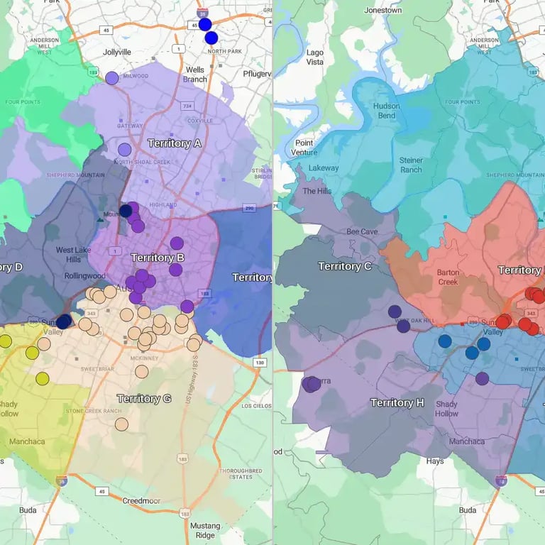
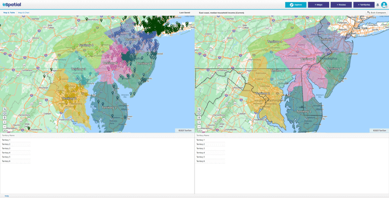
territory-comparison-split-screen

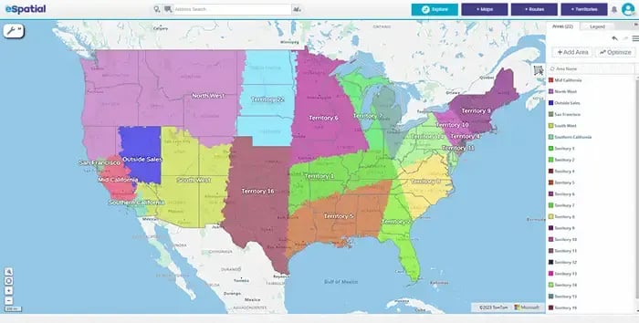
Stage 2: Territory Management Balance & Optimize

Balance sales territory workloads in real time using your real-world critical KPIs. Operations teams eliminate territorial disputes and reduce planning cycles by up to 95%. Territory optimization alone boosts revenue by 7% without adding resources.

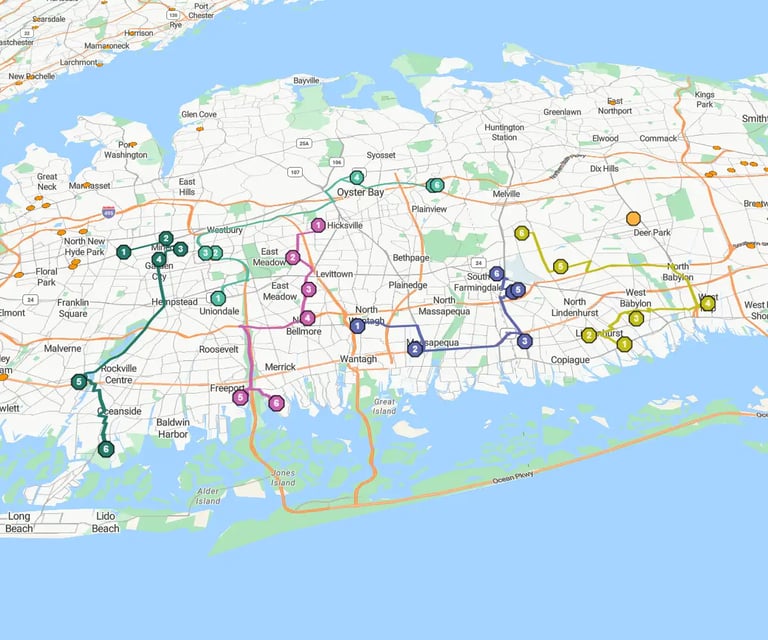
route-map-oyster-bay-roadmap-angled

Stage 3: Route Optimization Execute & Scale

Optimize multi-stop field sales and service routes after you've balanced boundaries. Field reps cut windshield time, driving up to a 20% lift in field productivity. That's more time selling, servicing and with customers.


See the 3-Stage Process in Action


How Does Raw CRM & Spreadsheet
Data Transform Into Interactive Maps?


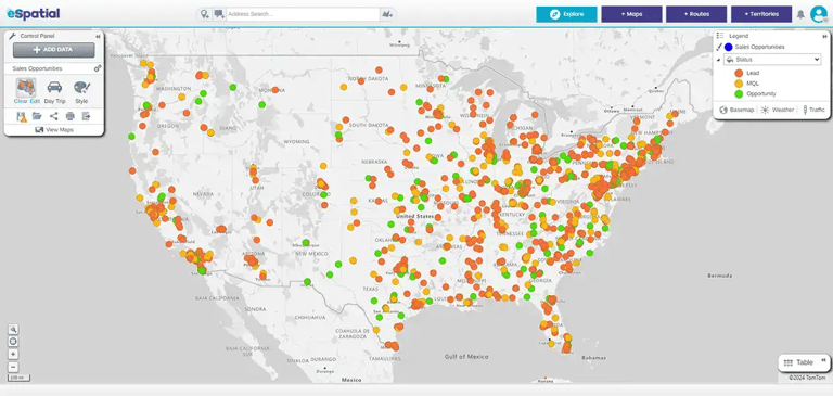
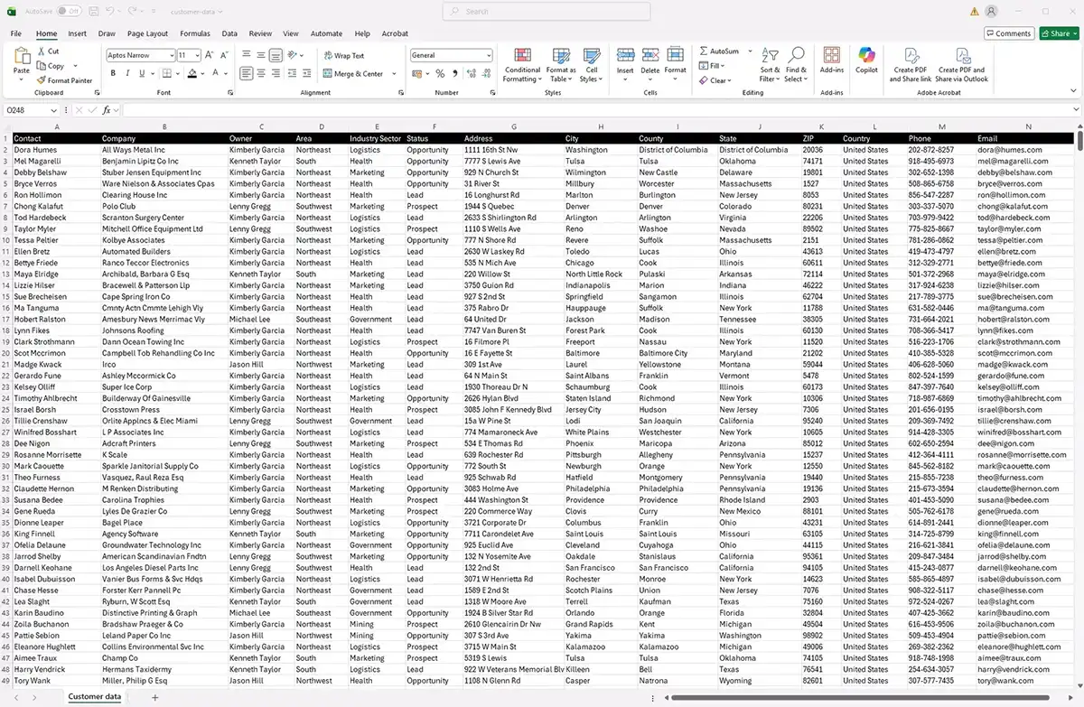
Modern business mapping software transforms raw CRM records and spreadsheets into interactive visual maps using intelligent geocoding and sophisticated algorithms. Instantly reveal high-density customer clusters, regional market gaps, and untapped revenue opportunities without requiring specialized GIS expertise.

Here’s the problem with spreadsheets. They hide the geography. They ignore travel time. So every perfect spreadsheet plan looks great until it hits geographic realities, like rivers, lakes, mountains, account densities. When customers' location data is locked in text tables, plans misalign. Strategy and execution miss the targets. Bridging CRM datasets with interactive maps gives team leaders immediate clarity:

Instant Batch
Geocoding

Upload thousands of customer addresses. The platform processes large datasets seamlessly, placing accurate color-coded pins across national, regional, or postal boundaries in seconds. That’s instant insight.

Multi-Layer
Dataset Overlay

Combine active customer accounts, prospective leads or competitor locations, and demographic datasets on a single map layer. Compare high-value account clusters against market potential without switching tools.

Heatmaps &
Density Analytics

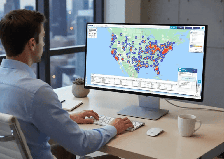
Identify high-performing territories and underserved regions at a glance. Visual heatmaps help sales and operations leaders allocate rep capacity where revenue potential is highest.

Native Salesforce Integration
& CSV Data Sync

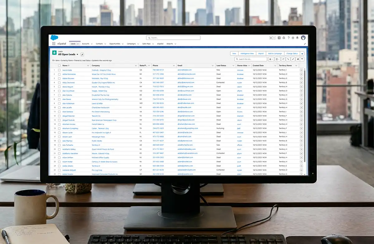
Connect natively with Salesforce or import custom spreadsheet fields, ensuring map insights update automatically as your location records evolve.

How Do You Balance Sales & Field
Workloads Without Spreadsheet Friction?


To balance sales and field workloads without spreadsheet friction, modern mapping software automates territory management using real-time KPIs, postal boundaries, and workload modeling. It is 95% faster and eliminates manual alignment errors. That speed means you can share scenarios with your wider team, which in turn resolves rep disputes, and reduces disruption.

Manual spreadsheet modeling forces operations leaders into longer realignment cycles, copying rows, building formulas, and creating geographic boundaries. It's a static process that leaves sales territories unbalanced (even though the spreadsheet says different), overburdening top performers while leaving other regions underserved. Automating sales territory alignment enables data-driven workload balancing:

Man viewing pin map on desktop device
Pin map USA

1. Dynamic Workload Balancing

Balance sales territory workloads using actual customer data, revenue targets, and visit frequencies rather than basic demographic counts. The workload algorithm does the heavy lifting by calculating drivetime. That’s the critical difference as it helps avoid imbalances.

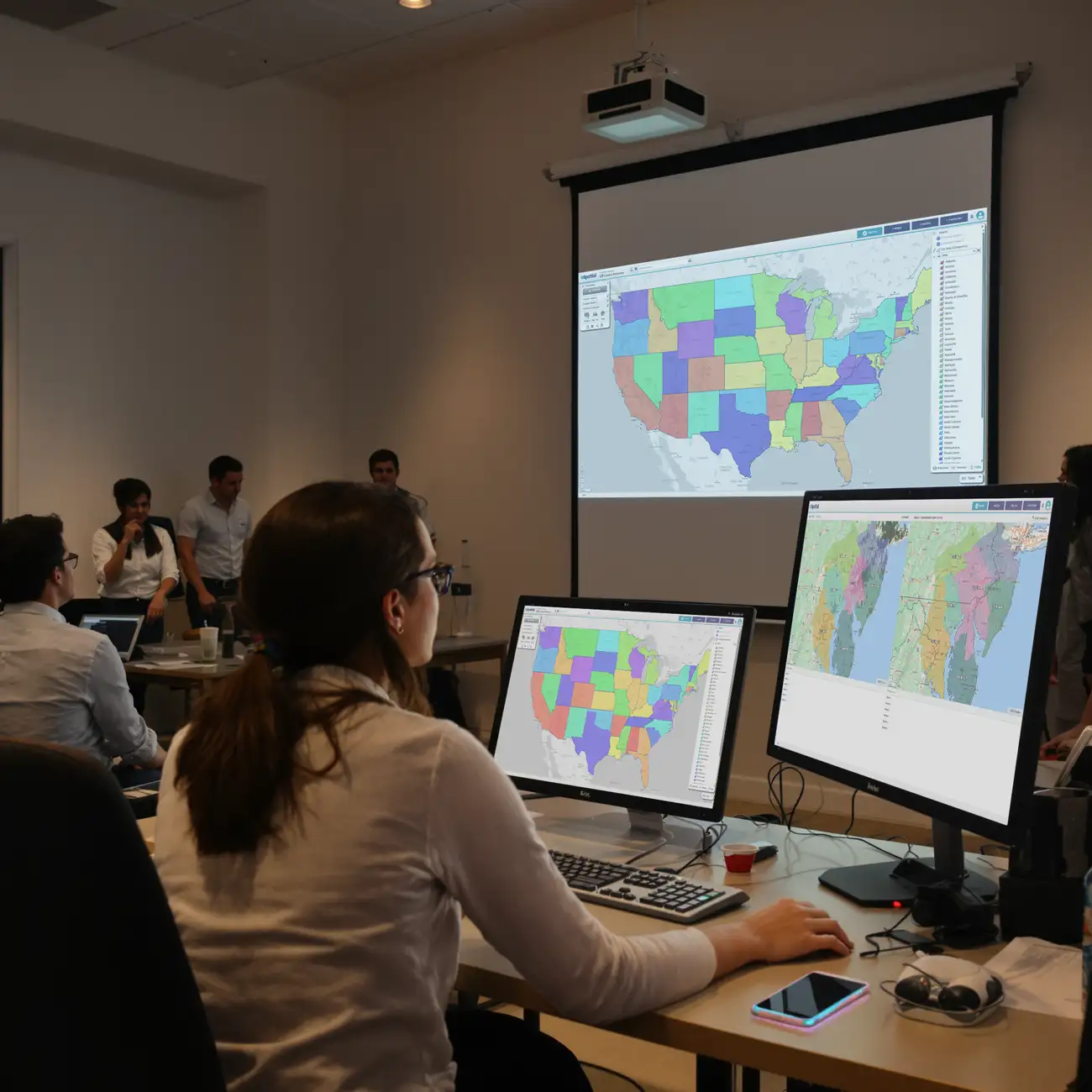
Team meeting reviewing territory map on projector
Territory comparison map

2. Real-Time Scenario Modeling

Model dynamic territory scenarios instantly, allowing operations managers to compare side-by-side impact metrics before finalizing boundary shifts.

Team meeting reviewing route map
Regional territory data

3. Collaborative Stakeholder Alignment

Operations leaders share visual boundary proposals directly with sales directors, building rapid consensus and cutting realignment projects from months to hours.

Team meeting reviewing route map
eSpatial for Salesforce territory map

4. Flexible CRM Deployment

Connect natively with Salesforce to push territory changes directly or export multi-format CSV files to update account ownership across any CRM system without technical friction.

Key Takeaway: Avoiding disruption among customers and field teams is as easy as sharing an interactive territory alignment scenario with your team and getting instant feedback. That local knowledge is irreplaceable and helps perfect the final designs. It leads to fewer disputes, which is the single biggest reason many organizations defer territory redesigns. They know it is important, but fear the fallout.

How Does Route Optimization Reduce
Windshield Time and Elevate Field Productivity?


Route optimization transforms balanced territory maps into efficient daily itineraries. By automatically sequencing multi-stop journeys using real-time road data, route mapping software reduces field rep windshield time, cuts travel expenses, and delivers up to a 20% lift in field sales productivity.

Unplanned driving and inefficient travel plans waste customer facing or billable hours, forcing field reps to spend more time behind the wheel than in front of clients. Route optimization built on top of poor territory designs creates friction. Routes built on mathematically balanced territories unlock true field efficiency. Streamline field execution by turning territory plans into optimized daily journeys:

1
Step 1

High-Capacity Multi-Stop Sequencing

Sequence 100+ daily stops in seconds with instant batch processing.

2
Step 2

Precise Drive-Time & Radius Analysis

Calculate multi-stop journeys using real-world traffic data and precise drive-time boundaries rather than basic straight-line distance.

3
Step 3

Measurable Field Productivity Lift

Reducing windshield time results in up to a 20% increase in daily customer visits.

4
Step 4

Seamless Mobile Route Execution

Export optimized itineraries directly to rep mobile devices, ensuring field teams execute daily schedules with total accuracy.

5
Step 5

Easy Reoptimization

When the plan gets derailed, easily reoptimize your routes and protect your most valuable selling or service hours.

Balance Your Territories in Minutes


How Does Business Mapping Software Intelligence
Drive Operational ROI Across Key Industries?


Spatial intelligence drives operational ROI across key industries by optimizing sales and service territories to maximize revenue potential. Optimizing field service routes, and surfacing regional demand patterns. By replacing static spreadsheets with dynamic interactive maps, organizations achieve up to a 95% planning time reduction.

Location intelligence delivers immediate ROI when tailored to vertical operational challenges. eSpatial easily adapts to industry-specific needs, and field logistics across 11 primary sectors:

ekg-machine-surgeons-in-background

Healthcare & Medical Devices

Align provider coverage networks, streamline medical sales representative visits, and balance territory workloads for global healthcare leaders including Thermo Fisher and LivaNova.

cement-mixer-in-front-of-construction-site

Manufacturing & Construction

Map regional distribution centers, optimize heavy fleet delivery routes, and streamline site logistics for building material providers like Lauren Concrete.

Hotspot heatmap on a desktop computer

Commercial Sales & Services

Visualize customer account density, automate territory realignments, and reduce windshield time to unlock up to a 7% increase in overall revenue.

people-in-shopping-center

Retail & Franchise Operations

Evaluate new store location potential, analyze regional demographic density, and identify underserved market gaps to guide expansion strategies.

How Does Business Mapping Software
Compare to BI Tools Like Tableau or Power BI?


Traditional BI tools like Tableau or Power BI display basic pin maps, but specialized business mapping software like eSpatial provides deep spatial analytics. It offers automated territory balancing, multi-stop route optimization, drive-time analysis, and dynamic CRM data clustering out of the box.

General BI platforms excel at rendering high-level charts, but they struggle with hands-on geographic execution. Displaying location data as passive map pins prevents operations leaders from dynamically balancing territories or sequencing field routes. Dedicated location intelligence platforms bridge the gap between passive reporting and active field execution:

What Security Standards Guarantee
Secure Location Data Management?


Uploading proprietary CRM records and revenue targets to cloud platforms requires documented data protection. Enterprise-grade mapping systems implement multi-layered administrative, technical, and physical security controls to safeguard customer information both at rest and in transit. Robust security standards protect operational datasets at every tier:

ISO 27001

Third-party audits verify world-class information security management frameworks and operational controls.

Data Encryption Standards

Full data protection using TLS encryption for all web transmissions alongside comprehensive encryption for stored customer data and backups.

Role-Based Access Controls

Restrict user privileges, map editing rights, and customer dataset visibility based on user job functions and regional jurisdictions.

Rigorous Disaster Recovery

A dedicated standby database maintains a 10-minute Recovery Point Objective (RPO) and a sub-2-hour Recovery Time Objective (RTO) to guarantee operational continuity.

Trusted by Businesses Globally


Join the leaders. Top teams across every industry use location intelligence to turn data into a competitive advantage. Sales: Hunt high-potential leads and balance territories. Operations: Optimise coverage and slash service costs. Marketing: Target high-growth regions and prove ROI.

★★★★★

eSpatial is Awesome

I have been using eSpatial for about a month and find it way more than I expected. Being able to easily utilize the system and visually seeing where incidents occur has helped us utilize resources more efficiently. The Customer Service is excellent.
★★★★☆

eSpatial is a great visual tool for mapping out leads, prospects, and current accounts

I appreciate the visual representation of all of the accounts and being able to connect the accounts with different filters and tools such as heat maps. It is a great organizational tool.
★★★★★

Great tool for creating custom maps and charts

This is a great tool for creating custom heat maps with our data. The CSV import makes it easy to upload and change data, and every point can show different markers. Very helpful for last minute presentations as well!
★★★★☆

Great tool for visualizing territories

We are able to send direct links to end users so they can visualize their areas of responsibility. Making changes to existing territories is very easy.
★★★★★

You must have no doubts, you must try

It is really very functional and effective for situations that require accurate data mapping. I like that I only have a little more than 20 days using it and I already feel like an expert. In addition, I love that I can establish effective data parameters to execute heat maps in a precise and personalized way.
★★★★★

Great Product!

This product is great and super easy to use. This has cut our route design timing in half. The customer service is fantastic!
★★★★★

The support is AMAZING and the tool is simple to use and works well!

The support is amazing. They reply right away every time! I have had two issues that needed resolution within an hour and their support team came through on both times.
★★★★★

Data Visualization Uncovers New Opportunities

The reason we selected and continuously renew our account is the outstanding support we receive each step of the way. eSpatial invests in your success and wants you to be getting the most out of their platform.
★★★★★

eSpatial is a lifesaver!

I have had nothing but success with eSpatial. When previous products were limited in their abilities (map sharing, dynamic maps, etc.).
★★★★☆

Engel & Völkers Americas

At E&V we use this software as a sales tool to show prospects their "territory" first hand. We also are able to create maps using address points to make it easier for our sales team to navigate larger areas of the US to make better use of their time.
★★★☆☆

Easy to use limited in customization

How easy the program is to learn. Easy to import new data.
★★★★☆

Great tool to help our non-profit plan

We appreciate the ability to layer multiple variables at a time.
★★★★★

User Friendly Mapping

I love how easy it was to learn how to map on this software. The set-up was not difficult either and they had a representative reach out personally to help you with your account whether you wanted a phone call or email help.
★★★★★

Great Collaborative platform!

I run a small team that responds to inbound leads with the purpose of qualifying and setting up meetings for our Sales partners. With the higher volume and tight turnaround times we deal with, a collaborative plugin like eSpatial is invaluable.
★★★★★

Bulletproof - Program And People

The program works flawlessly. It's so easy to add data, change the view, isolate territories - total flexibility.
★★★★☆

Excellent Data Visualisation

Ability to customise heat maps and overlay multiple data sets.
★★★★★

Fantastic product and service

This system provides a tremendous insight into our trading locations to allow us to make dynamic decisions. The team and after sales care are in keeping with the systems quality.
★★★★☆

Great program that's simple to use

eSpatial is very user-friendly, allowing us to spend little time implementing and training how to use the software. When we had issues, their excellent customer service was quick to respond.
★★★★★

Most User Friendly Mapping Tool & White Glove Customer Service!

Constant tool enhancements, extremely helpful & quick customer support, user friendly / great UI, easy to upload data, territory balancing option quick to learn / no implementation needed.
★★★★★

eSpatial is Awesome

I have been using eSpatial for about a month and find it way more than I expected. Being able to easily utilize the system and visually seeing where incidents occur has helped us utilize resources more efficiently. The Customer Service is excellent.
★★★★☆

eSpatial is a great visual tool for mapping out leads, prospects, and current accounts

I appreciate the visual representation of all of the accounts and being able to connect the accounts with different filters and tools such as heat maps. It is a great organizational tool.
★★★★★

Great tool for creating custom maps and charts

This is a great tool for creating custom heat maps with our data. The CSV import makes it easy to upload and change data, and every point can show different markers. Very helpful for last minute presentations as well!
★★★★☆

Great tool for visualizing territories

We are able to send direct links to end users so they can visualize their areas of responsibility. Making changes to existing territories is very easy.
★★★★★

You must have no doubts, you must try

It is really very functional and effective for situations that require accurate data mapping. I love that I can establish effective data parameters to execute heat maps in a precise and personalized way.
★★★★★

Great Product!

This product is great and super easy to use. This has cut our route design timing in half. The customer service is fantastic!
★★★★★

The support is AMAZING and the tool is simple to use and works well!

The support is amazing. They reply right away every time! I have had two issues that needed resolution within an hour and their support team came through on both times.
★★★★★

Data Visualization Uncovers New Opportunities

The reason we selected and continuously renew our account is the outstanding support we receive each step of the way. eSpatial invests in your success and wants you to be getting the most out of their platform.
★★★★★

eSpatial is a lifesaver!

eSpatial has set out to crush it from day one. Any improvement that I've suggested has eventually been implemented, and the customer service/support is TOP NOTCH.
★★★★☆

Engel & Völkers Americas

At E&V we use this software as a sales tool to show prospects their "territory" first hand. We also are able to create maps using address points to make it easier for our sales team to navigate larger areas of the US to make better use of their time.
★★★☆☆

Easy to use limited in customization

How easy the program is to learn. Easy to import new data.
★★★★☆

Great tool to help our non-profit plan

We appreciate the ability to layer multiple variables at a time.
★★★★★

User Friendly Mapping

I love how easy it was to learn how to map on this software. The set-up was not difficult either and they had a representative reach out personally to help you with your account whether you wanted a phone call or email help.
★★★★★

Great Collaborative platform!

I run a small team that responds to inbound leads with the purpose of qualifying and setting up meetings for our Sales partners. With the higher volume and tight turnaround times we deal with, a collaborative plugin like eSpatial is invaluable.
★★★★★

Bulletproof - Program And People

The program works flawlessly. It's so easy to add data, change the view, isolate territories - total flexibility.
★★★★☆

Excellent Data Visualisation

Ability to customise heat maps and overlay multiple data sets.
★★★★★

Fantastic product and service

This system provides a tremendous insight into our trading locations to allow us to make dynamic decisions. The team and after sales care are in keeping with the systems quality.
★★★★☆

Great program that's simple to use

eSpatial is very user-friendly, allowing us to spend little time implementing and training how to use the software. When we had issues, their excellent customer service was quick to respond.
★★★★★

Most User Friendly Mapping Tool & White Glove Customer Service!

Constant tool enhancements, extremely helpful & quick customer support, user friendly / great UI, easy to upload data, territory balancing option quick to learn / no implementation needed.
★★★★★

eSpatial is a very easy to use mapping tool for various business needs

Easy to upload data and format maps. Heat maps give us a quick view of our business and the radius and filters help us make business decisions.
★★★★★

eSpatial has been a great partner and their platform helps us in many aspects of sales planning

A great onboarding/training program helps hit the ground running. The dedicated success team is quick to respond, takes feedback, and continues to check in on our needs.
★★★★★

eSpatial is easy to use, maps are visually appealing, and the customer support is fantastic

Any time I have had a question or concern, the support team has responded very quickly and addressed all of my needs with the software.
★★★★☆

Great integration options & helpful support team

The ability to route at a postal code level and layer it among other data.
★★★★★

Wonderful application!

The ease of use and system functionality allow you to generate customized maps.
★★★★☆

Easy to use mapping and territory creator for logistics company

eSpatial is extremely easy to use when it comes to creating maps or territories. We utilize this to keep up with and modify the areas in which we service our customers.
★★★★★

Very Easy and Intuitive

I like the ability to be able to easily plan my routes for my sales calls. It helps me make the most of the time I have and the miles I drive, and allows me to hit my goals more easily than if I were just flying by the seat of my pants.
★★★★★

Great Customer Support

The customer support is fantastic. I wish that every company serviced their customers like eSpatial.
★★★★★

Advancing Your Business Development and Growth

I like best about eSpatial is the ease of the tool and support from the eSpatial team.
★★★☆☆

Use eSpatial for simple policy mapping

Updates to maps in my eSpatial account automatically sync to the webpages where I have them linked.
★★★★★

Mapping

The ability to slice a data set into different maps and share them with non-licensed users.
★★★★☆

Good Mapping System for Corporate Customers

I like the user interface and how you can manipulate the layers and appearances of the maps.
★★★★★

Great Out of The Box UI and Fantastic Customer Support

Easy to map and design territories; clean UI.
★★★★★

Great product

Excellent reaction time, accuracy, customer service.
★★★★★

eSpatial Was Definitely the Right Choice for my Company

User-friendly, powerful, visually attractive, accurate, with robust data integration.
★★★★★

Amazing Product. Otherwordly Support

I use eSpatial to plot sales by zip codes for retailers and their competitors. The mapping helps me to better focus digital advertising, decide y/n on cable zones, and to measure effectiveness of changes in media plans. Clients love it, because . . . well, the map has life. A spreadsheet does not.
★★★★☆

There was a change in the website design but I preferred the old one

Something that is good about eSpatial is for planning proximity purposes, it is a good tool.
★★★★★

A Great Tool for Mapping Customers and for Marketing

The ease of use. The platform makes uploading data and mapping extremely easy. This is not limited to just customer data.
★★★★★

Strategic Mapping of College Sports Fans

Visualizing the data through heat maps or radius maps allows me to tell a positive story that is easy to comprehend.
★★★★★

eSpatial is a very easy to use mapping tool for various business needs

Easy to upload data and format maps. Heat maps give us a quick view of our business and the radius and filters help us make business decisions.
★★★★★

eSpatial has been a great partner and their platform helps us in many aspects of sales planning

A great onboarding/training program helps hit the ground running. The dedicated success team is quick to respond, takes feedback, and continues to check in on our needs.
★★★★★

eSpatial is easy to use, maps are visually appealing, and the customer support is fantastic

Any time I have had a question or concern, the support team has responded very quickly and addressed all of my needs with the software.
★★★★☆

Great integration options & helpful support team

The ability to route at a postal code level and layer it among other data.
★★★★★

Wonderful application!

The ease of use and system functionality allow you to generate customized maps.
★★★★☆

Easy to use mapping and territory creator for logistics company

eSpatial is extremely easy to use when it comes to creating maps or territories. We utilize this to keep up with and modify the areas in which we service our customers.
★★★★★

Very Easy and Intuitive

I like the ability to be able to easily plan my routes for my sales calls. It helps me make the most of the time I have and the miles I drive, and allows me to hit my goals more easily than if I were just flying by the seat of my pants.
★★★★★

Great Customer Support

They ask the right questions to get an understanding of what you need to accomplish with the software. Their overall knowledge of the practical way to use the software of the software is phenomenal.
★★★★★

Advancing Your Business Development and Growth

I like best about eSpatial is the ease of the tool and support from the eSpatial team.
★★★☆☆

Use eSpatial for simple policy mapping

Updates to maps in my eSpatial account automatically sync to the webpages where I have them linked.
★★★★★

Mapping

The ability to slice a data set into different maps and share them with non-licensed users.
★★★★☆

Good Mapping System for Corporate Customers

I like the user interface and how you can manipulate the layers and appearances of the maps.
★★★★★

Great Out of The Box UI and Fantastic Customer Support

Easy to map and design territories; clean UI.
★★★★★

Great product

Excellent reaction time, accuracy, customer service.
★★★★★

eSpatial Was Definitely the Right Choice for my Company

User-friendly, powerful, visually attractive, accurate, with robust data integration.
★★★★★

Amazing Product. Otherwordly Support

I use eSpatial to plot sales by zip codes for retailers and their competitors. The mapping helps me to better focus digital advertising, decide y/n on cable zones, and to measure effectiveness of changes in media plans. Clients love it, because . . . well, the map has life. A spreadsheet does not.
★★★★☆

There was a change in the website design but I preferred the old one

Something that is good about eSpatial is for planning proximity purposes, it is a good tool.
★★★★★

A Great Tool for Mapping Customers and for Marketing

The ease of use. The platform makes uploading data and mapping extremely easy. This is not limited to just customer data.
★★★★★

Strategic Mapping of College Sports Fans

Visualizing the data through heat maps or radius maps allows me to tell a positive story that is easy to comprehend.

Strategic Mapping Solutions


Support From Our Experts When You Need It


Sales and CS team

You're the expert on your data and line of work, but you may need some backup to complete your project. Your support team includes mapping (GIS) experts who will help you onboard faster with one-to-one guidance. They'll walk you through setting up your maps and map software, importing your data, and building the specific analyses that matter most to your business goals.

Ready to Start Your Mapping Project?


eSpatial gives you the tools to move fast and make an impact, whether you’re mapping customers, building smarter territories, or planning optimal routes. You don’t need a GIS expert; you just need your data and a few minutes to start.

Try it free today or book a quick demo with our team and see how mapping can transform your business.

Mapping Guides


Frequently Asked Questions


Business mapping software is a cloud platform that converts raw CRM records and address spreadsheets into visual maps. It enables sales, revenue, and field operations teams to discover account density, balance sales territories, and optimize multi-stop field routes without requiring technical GIS expertise.

Traditional Business Intelligence (BI) tools provide static pin maps for reporting, but lack execution workflows. Specialized business mapping software offers active territory rebalancing, automated workload alignment, road-network route optimization, and drive-time radius calculations out of the box.

Yes. Modern business mapping software offers native integration with CRMs like Salesforce to update account assignments directly, as well as flexible CSV export options to update territory ownership across any CRM platform.

Advanced business mapping engines can process and sequence 100+ daily stops per route in seconds using real-world traffic data and precise drive-time boundaries, compared to standard tools capped at lower limits.

Cloud mapping software protects data through ISO 27001:2022 certified management systems, hosting on secure public cloud infrastructure like Oracle Cloud Infrastructure (OCI), TLS encryption in transit, encryption at rest, and strict role-based access controls.

You appear to be offline at the moment, this notice will disappear once your device can connect to the internet again