Postcode Mapping Software


Map your sales, marketing, operations and business data by postcode with eSpatial

What You Can Do With
Postcode Mapping Software


UK postcode mapping is ideal when analyzing sales, marketing, and business data. When mapping postcodes with eSpatial, you can easily layer multiple datasets on a single map. You can also access other mapping tools like heatmaps and pin maps, and a suite of other professional map tools.

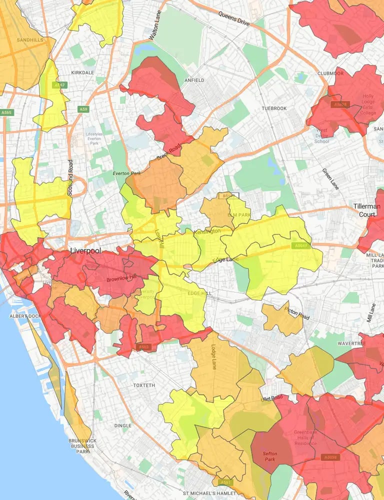
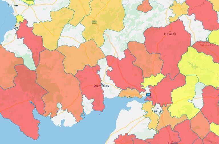
Postal code heat map in the UK

Comparison Analysis

Postal code mapping is great for comparing data in geographic areas. For example:

  • A Marketing Director might visualize men aged 35-50 per postcode concentration when launching a new product campaign.
  • A Sales Director might map sales revenue by postcode to identify gaps in coverage.
  • A Service Manager might map the number of service calls per postcode to ensure the right resources are deployed.
  • A Logistics Manager could map customer locations by zone to ensure they can commit to a one-hour delivery time.

The best way to compare data by postcode is with a regional heat map. These maps use color shading to show differences across each area. You can instantly spot high-revenue postcodes and areas that may need more sales or marketing support.

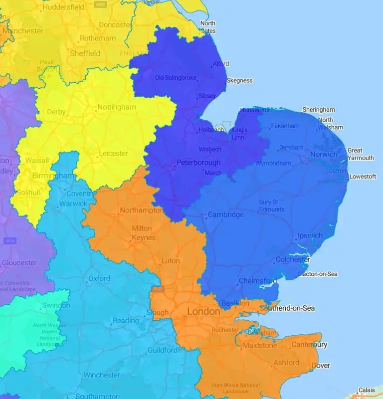
Territory map, UK east coast

Territory Mapping

Territory mapping is critical for planning which sales or service person will cover a specific geographic area. Postcodes are the smallest boundaries you can work with, which makes it easier to design manageable territories for each rep. If you need to create an account-based territory or use a mixed model of accounts and geographies, eSpatial can help.

You can balance territories on workload or using a weighting (for example, you want each rep to spend 60% of their time with existing customers and 40% with prospects). If you assign leads by postal code, you can balance your territories by lead volumes. For more information, check out our Conquering territory management guide.

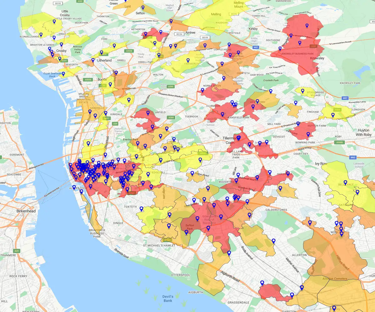
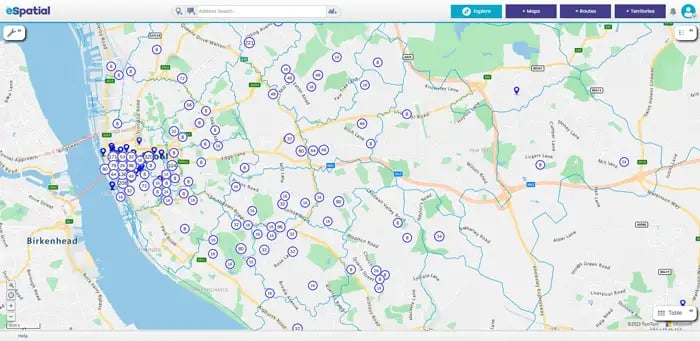
Pin map of Liverpool

Delivery Zone Planning

With postal code mapping software, you can quickly create clear, balanced delivery zones based on real data. You can easily see which postcodes fall into each zone, helping reduce overlaps, cut travel time, and improve customer service. This makes your delivery planning faster, smarter, and more reliable.

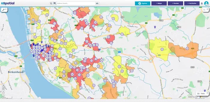
Liverpool post code heat map

Gap & Opportunity Analysis

Use postcode mapping software to uncover hidden gaps in your market and pinpoint areas with untapped potential. For example, a heat map can quickly highlight postcodes with low customer density or missed sales. By combining this with pin maps or territory maps, you can focus your efforts on where they’ll make the biggest impact.

Use Cases


Postcode mapping gives sales leaders and operations teams the control and visibility they need to grow the sales pipeline, improve coverage, and increase close rates. Every single aspect of your business can benefit from postcode mapping. Here are some examples of how it’s done.

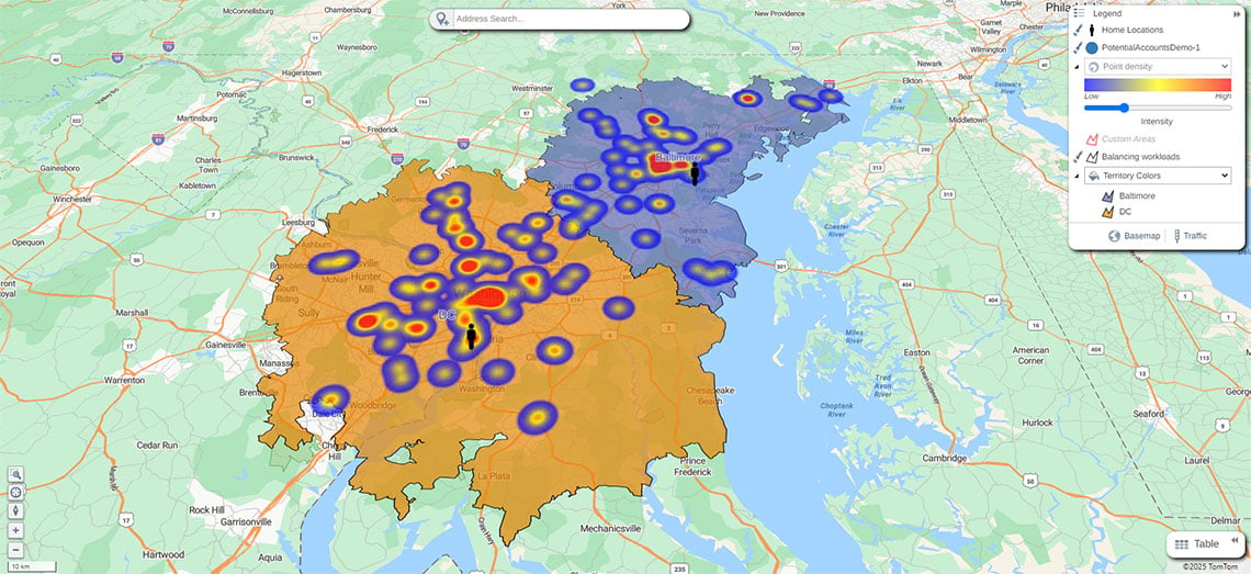
Territory and hotspot heat map

Sales & Territory Management

Create balanced sales territories by postcode. Visualize sales performance clearly and identify areas for growth quickly. Explore our mapping software for sales teams and territory management.

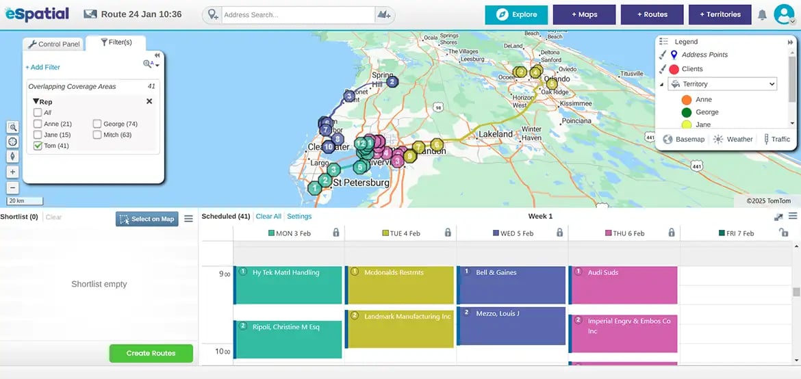
Route map

Logistics & Delivery Planning

Plan efficient delivery zones using our postcode mapper. Reduce overlaps and cut travel time. Improve customer service with our route optimization tools.

Pins over a regional heat map

Retail Site Selection

Analyze customer and competitor locations by postcode. Find the best spots for new stores and make data-driven expansion decisions. Learn more about retail mapping.

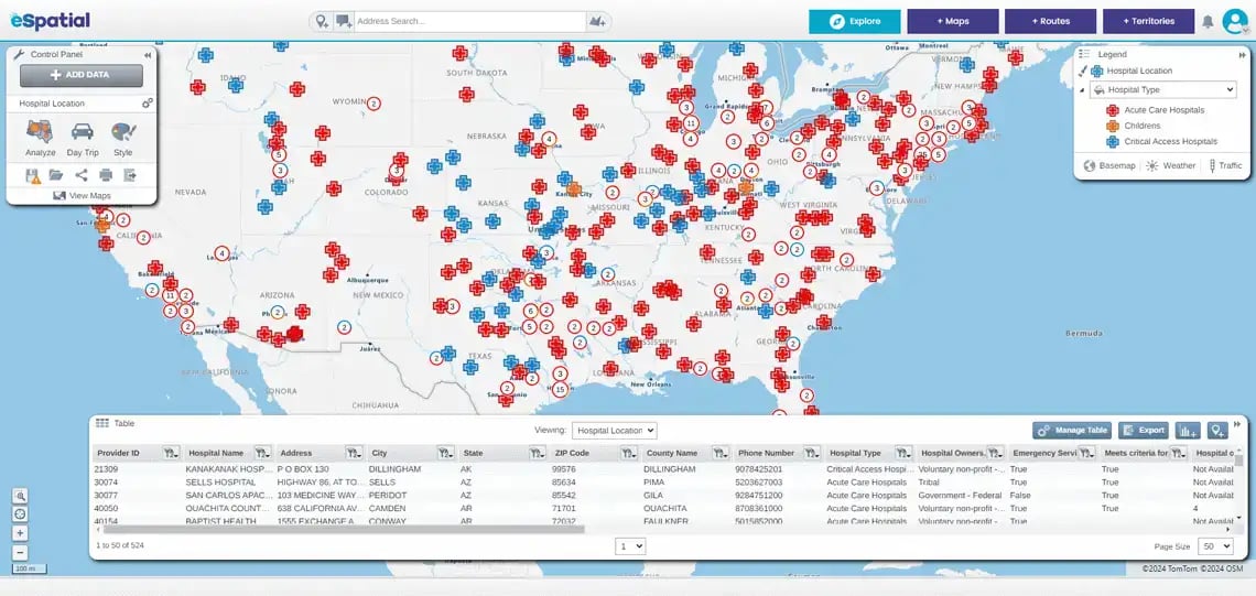
Medical facilities, USA

Healthcare & Service Area Mapping

Map patient or service data by postcode. Allocate resources based on coverage gaps and enhance outreach and service delivery. Explore eSpatial's mapping software for healthcare.

Why Choose eSpatial for UK
Postcode Mapping Software?


  • Simple to use - Create your map in three steps

  • It is a fully integrated platform with maps like heat maps, pin maps, and bubble maps, and you can add territory and route optimization

  • Flexible range of styling options - Customise to your tastes

  • Available where you work - Get eSpatial for Salesforce, Apple, and Google Play stores

  • Free trial, including world-class eSpatial support to help you get started

  • Easy sharing and publishing options

How Do I Create a UK Postcode Map?


Building a postcode map in eSpatial is really easy. With just a few guided steps, you can go from sign-up to a fully customized, data-rich map. Here’s how to get started with our postcode mapping tool.

Step 1

Sign up for a Free Trial

With eSpatial, you can sign up for a free trial to access all our professional features so you can start mapping immediately. No credit card details are required. Once you've signed up, log in to eSpatial.

Create your first map now

eSpatial requires JavaScript to run. Please enable JavaScript to sign up for a free trial

Once you sign up you will receive an email from no_reply@espatial.com with a link to activate your trial

Step 2

Select and Customize Your Postcode Data

After logging in, you will be presented with 4 map type options. Choose Pin Map to begin with. On the next screen, click on Add from Library, then make sure you're in the eSpatial datastore tab.

Once you’ve chosen your dataset, search for "post". This will bring up available postal code datasets. You'll receive a variety of results for the UK, including UK postal areas, districts, and sectors.

Areas are the largest postal code boundaries. These are divided into multiple districts, which are divided into sectors. Choose UK Postcode Sectors if you'd like to use the smallest available boundaries.

If you'd like to add your own data to the map, you should first ensure your file is in the correct format. Once you've done that, click the Add Data button in the Control Panel on the left side of your screen to open a new menu screen. Click Upload new data, then select the file you'd like to upload.

Select add from library to find postal code datasets

Step 3

Analyze, Visualize, and Take Action

Once you've added your data, you can start analyzing it. Visualizing sales data geographically highlights overlaps, gaps, or inefficiencies in your coverage, enabling quick territory adjustments and smarter planning. Here are two popular uses for postcode mapping:

Regional heat map analysis will summarize and color the map by region, e.g. sales by state, allowing for comparative analysis.

Precision territory design using postcode boundaries lets you build balanced sales territories based on real-world geography.

Postal code heat map in the UK

Frequently Asked Questions


How Do I Create a Postcode Map?

Start with a free trial, choose your postcode data, and add your own data if needed. Then analyze, visualize, and act on the insights your map reveals.

eSpatial supports postcode and ZIP code data for many countries, so you can create maps beyond the UK.

Absolutely. You can filter, group, or color-code postcodes by sales, customers, or any other data to see patterns clearly.

You can build territories down to small postcode sectors for precise planning or use broader areas and districts for a bigger-picture view.

Ready to Build a Postcode Map?

Sign up for a 7-day free trial of eSpatial to start your postcode mapping today. If you need support, our eSpatial team includes geographic information system (GIS) qualified mapping experts who work with you.

They provide expertise in both mapping and data integration for onboarding and throughout your time using eSpatial.

You appear to be offline at the moment, this notice will disappear once your device can connect to the internet again