
The reality: Excel is built for spreadsheets, not maps. Its native charts lack the power needed for serious sales territory mapping.
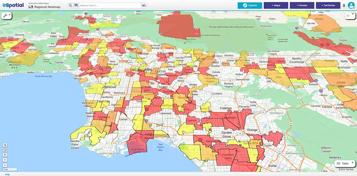
You cannot analyse complex geographic data with basic tools. You need a dedicated engine like eSpatial. We break down Excel’s mapping limitations and show how eSpatial’s heat mapping unlocks your data’s full potential.
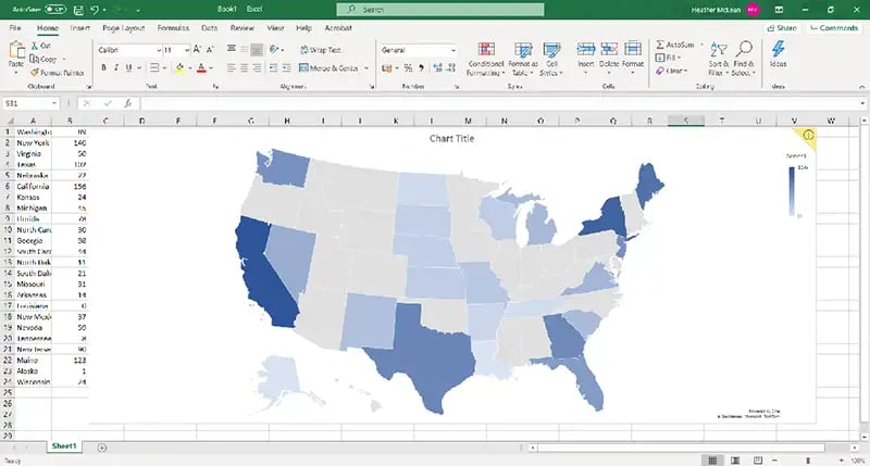
You can generate a "map chart," directly inside Excel, but it serves as a basic visualisation tool, not a comprehensive mapping engine.
How to do it: Select your data, one column for geography, one for metrics, and navigate to Insert > Maps > Filled Maps.
The catch: Excel struggles with granularity. It falters when you need deep customisation, multi-layered insights, or clear analysis of localised data.
Excel offers quick visuals, but its lack of depth and accuracy creates serious risks for strategic territory planning.
Decision-makers need precision. Excel’s limitations force you to spend more time troubleshooting errors than analyzing opportunities.
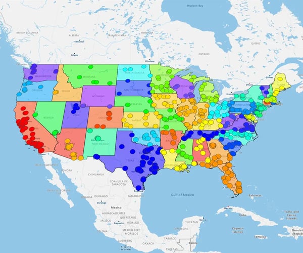
The 6 key failures:
- Coverage gaps: Fails on detailed administrative boundaries and specific postcodes
- Static images: You cannot filter, drill down, or interact with live data
- Rigid styling: Restricted to presets. You cannot add layers, annotations, or context
- Data errors: Frequently misinterprets place names or ignores rows it does not recognise
- No motion: Lacks animation, time-series mapping, or multi-dataset integration
- Scale failure: Large datasets (coverage, density) cause the tool to slow down or crash
Excel is for basic charts. For precision, customization, and clarity, you need a dedicated engine like eSpatial.
Make geographic analysis intuitive. Map ZIP codes, analyze sales territories, and uncover customer trends instantly. eSpatial geo mapping software gives you the clarity Excel can't.