4.8/5 of 53 reviews
4.3/5 of 38 reviews

Create a Geographic Heat Map


Upload your business data, analyze geographic point density, analyze regional density, share live maps, and export to JPEG or PowerPoint

Our Customers Love Mapping With eSpatial

  • RE/MAX logo
  • FedEx logo
  • Volvo logo
  • LG Electronics logo
  • Henkel Corporation logo
  • Continental Tire logo

1. Hot Spot Heat Maps

Kansas Heat Map
  • Identify clusters of customers.
  • Highlight opportunities outside of current territories.
  • Uncover trends in sales of particular products in particular locations.
  • Quickly spot areas for further investigation based on the density (or lack thereof) of sales.

2. Regional Heat Maps

  • Get an overview of your market performance.
  • Quickly identify high and low performing areas.
  • Uncover trends in sales of specific products in particular locations.
  • Quickly spot areas for further investigation based on the density of sales.
Customer satisfaction

Get Started With eSpatial Today

Our team is here to help you every step of the way

Customer success team

eSpatial Features Customers Love

Product - Territory / pin-map

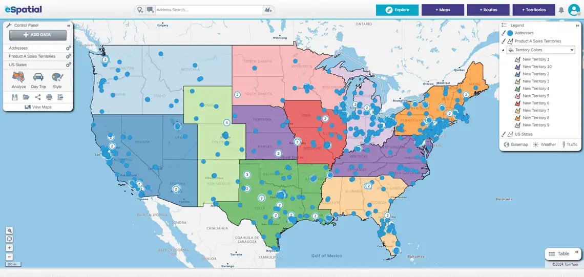
1. Territory Mapping and Management


Create, merge, align, optimize or balance territories up to 32x faster. Complete power territory mapping software for sales, marketing and operations. Boost revenue and slash design time. Simple, fast and secure.
Product - Route map

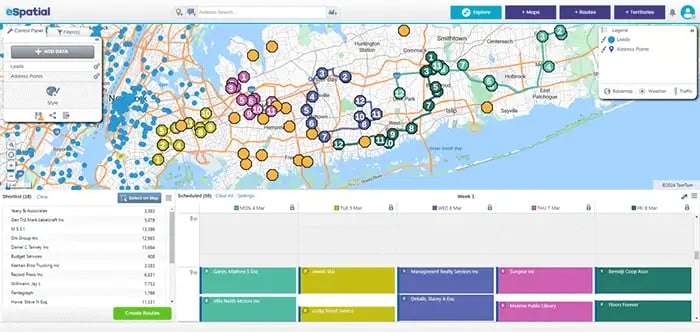
2. Route Mapping and Optimization


Optimize routing software for sales and service teams. Our advanced recommendations engine will help boost utilization and productivity. Mobile ready to allow users in the field instant access to up to date routes and schedules.
Product - Hotspot heat map

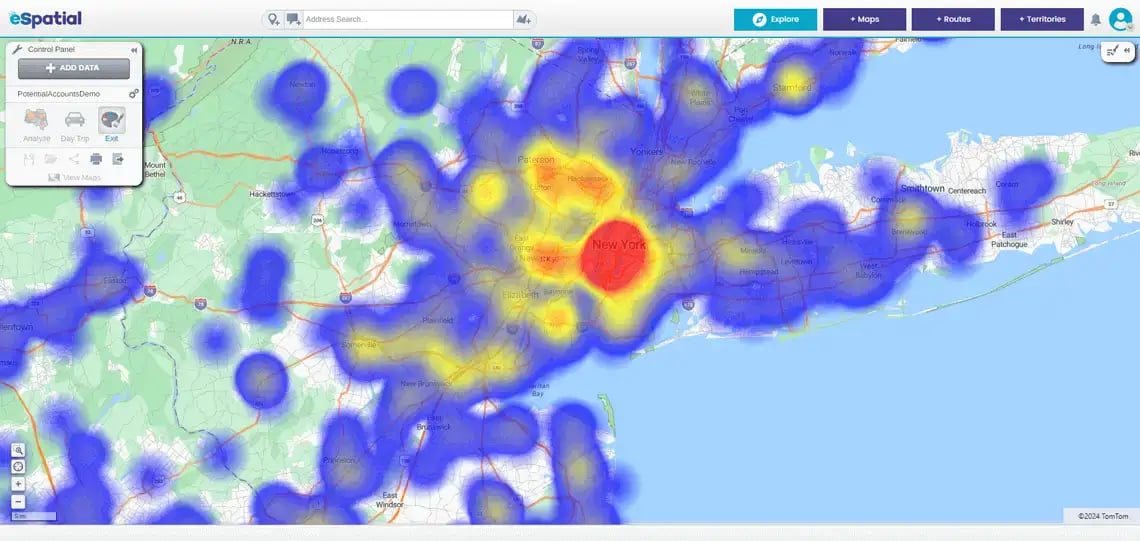
3. Create a Story With Your Data on Maps


Present your data on heat maps, radius maps, ZIP maps, proximity, and drive time maps. Gain new insights, spot trends, and unlock hidden opportunity.
Product - Territory map

4. Simple and Fast Power Mapping


Loved by thousands of users worldwide for being simple, fast, and powerful. Our product offers full support, talk to a real people in-person or in-app.
Product - Secure sharing

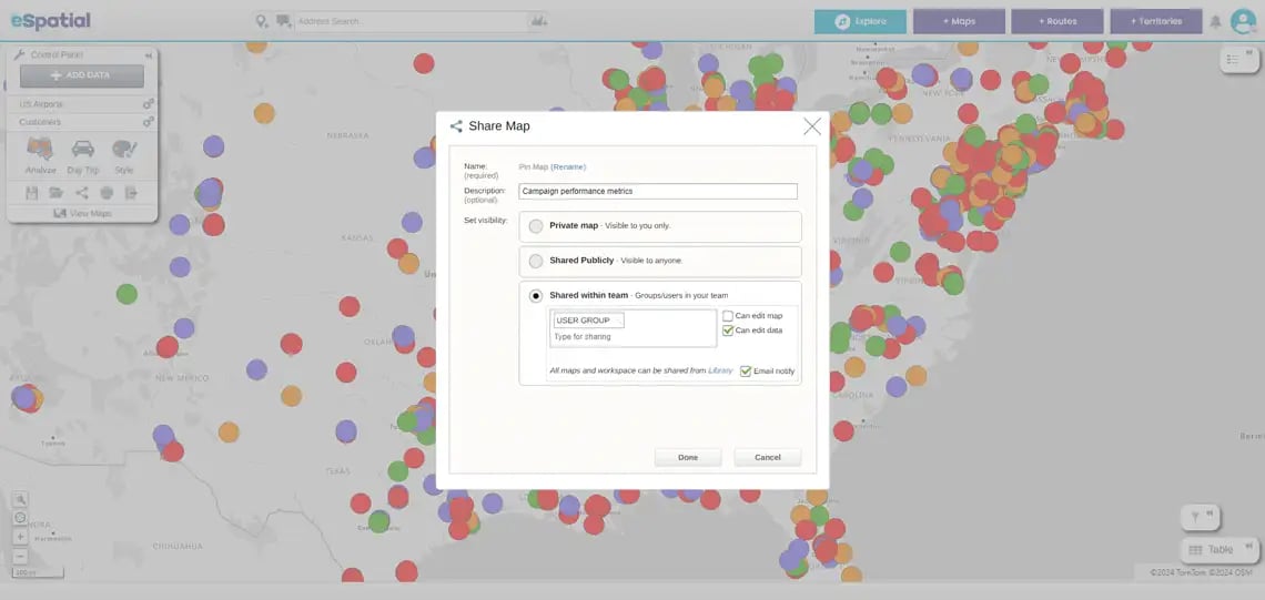
5. Collaborate Securely


You get the highest levels of security. Share and collaborate with colleagues and customers easily. Speed up your decision making process and increase buy-in.
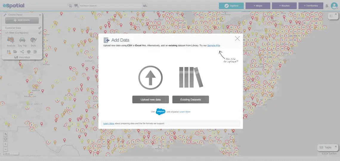
Product - Add data

6. Data Loading


Load Excel, CSV, and CRM data in seconds. Integrate seamlessly with your Salesforce data. Your data can be used to generate live interactive maps that can be shared privately or publicly.
What Can You Do With eSpatial?
  • Instantly see geographic trends and patterns.
  • Import, analyze, segment, and report on data.
  • Create maps for any country worldwide: use address, zip code, postcode, or county data.
  • Create geographic dashboards, heat maps, charts, and reports.
  • Filter and segment data with location analytics.
  • Embed maps on a website or blog.
  • Print, export, and share results both on and offline.
Why is eSpatial Different?
  • It is a complete mapping solution for data visualization, territory management, and routing.
  • You partner with a designated account manager who will ensure you reach your goals.
  • eSpatial includes free datasets like census, zip code, states, counties, and more.
  • eSpatial is cloud-based, so you are future-proofed. And it's quick and easy to get started and see results.
  • eSpatial provides a fully secure and confidential service, trusted and backed by 20 years of mapping experience.

About eSpatial

At eSpatial, we are passionate about harnessing the power of GIS to unlock business insight. It drives our approach to customer success. Our mapping experts are on a journey to develop the world's best sales optimization mapping tool.

We proudly serve over 4,000 customers globally.

You appear to be offline at the moment, this notice will disappear once your device can connect to the internet again