-
Getting Started
-
Video Resources
-
Data (Preparing/Adding/Editing)
-
Radius, Drivetime and Measurement Tool
-
Heat Mapping and Summary Analysis Tool
-
Territory Manager
-
Style
-
Data Table
-
Filtering Data
-
Routing
-
Saving, Exporting and Sharing Maps
-
Deleting
-
Managing / Organizing your Maps (Library)
-
Single Sign-On (SSO)
-
CRM & Data Integrations
-
eSpatial API
-
eSpatial Mobile
-
For Salesforce
-
eSpatial Frequently Asked Questions
-
eSpatial Troubleshooting
Radius Analysis
Radius map analysis will find points within a distance, e.g. customers within 10 miles of your store
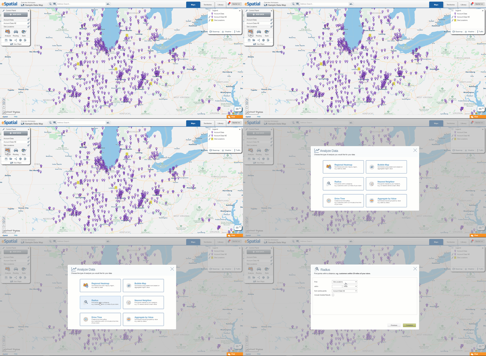
- To add Radius Map analysis to your map, click on the Radius Map button in the Analyze Data window.

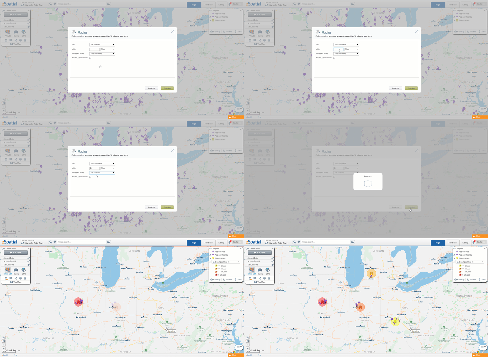
- Select the dataset you wish to use from the drop down.
- Set the distance by entering a number and selecting a distance type from the drop down.
- Select the From Center Points dataset you wish to use from the drop down.
- Click on the Complete button.
- Radius Analysis will be added to your map.

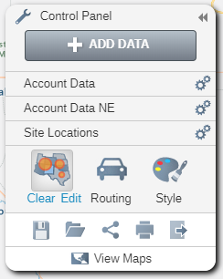
- Click on the Edit Analysis button on the Control Panel to edit the Radius analysis.
- Click on the Clear Analysis button on the Control Panel to clear the Radius analysis.
- Click on the Save as button on the Control Panel to save as a Radius Map.

